|
|
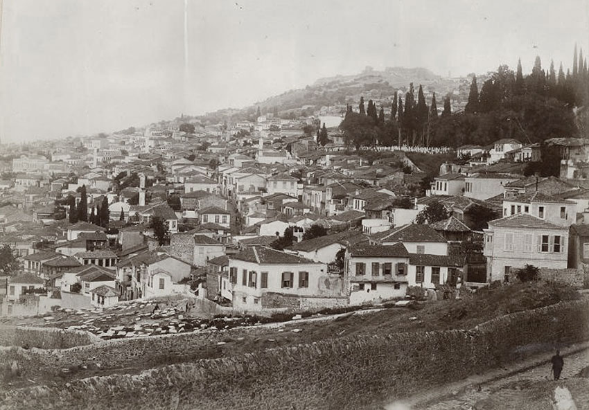
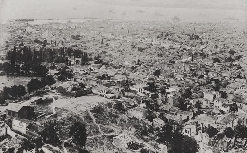
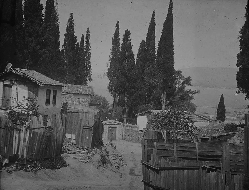
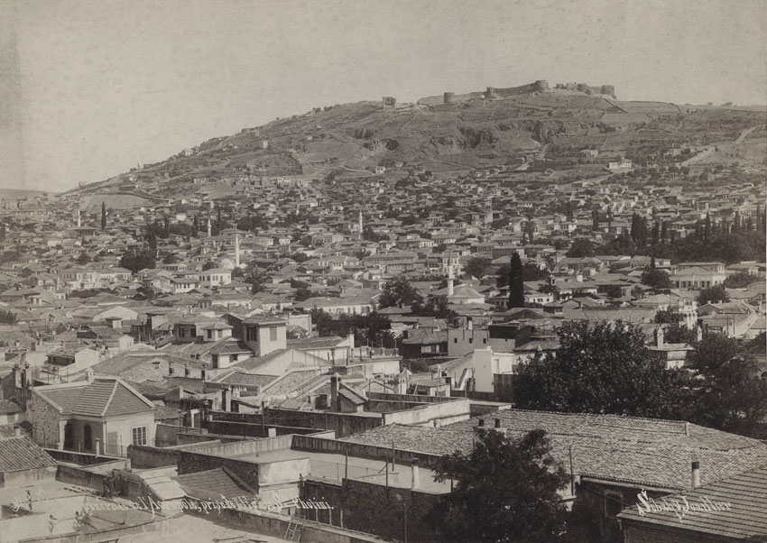
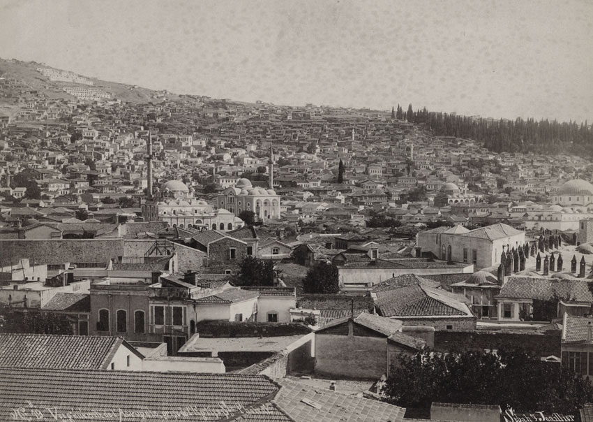
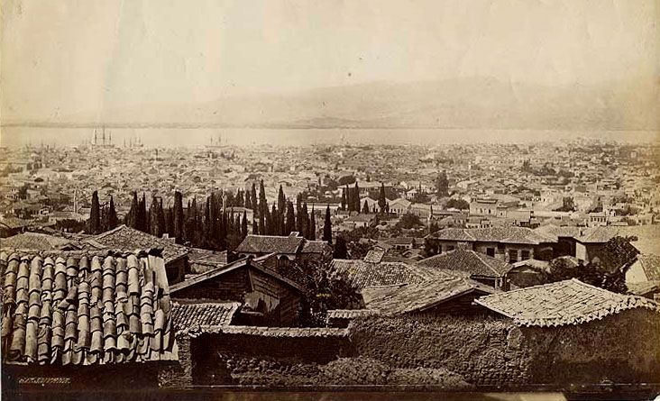
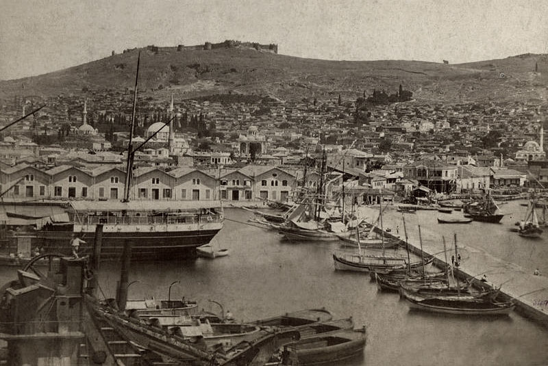
The Turkish quarter of Smyrna, taken
around the 1880s, but the above viewing inland, with Mount Pagus in the
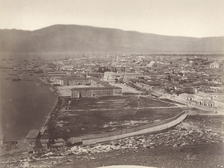
background and the second, looking in the opposite direction (photographer F. Firth). Bottom image (similar period, Bonfils)
is around turn of century, clearly showing the barracks. |
|
|
|
|
|
|
|
|
|
|
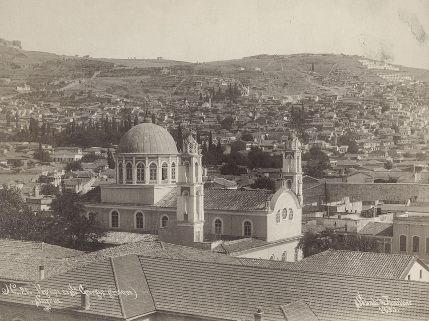
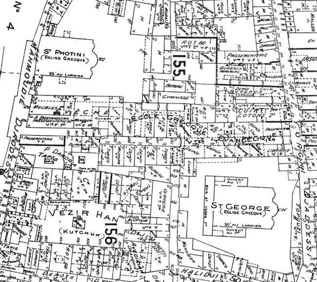
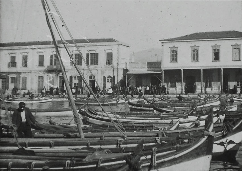
These two images above seem to have been taken from the clock tower of Agia Photini Greek Orthodox Church, showing Agia George (Yorgos) Church in the background and the Greek Evangeliki School complex in between, as seen from the 1905 Goad map below. |
|
|
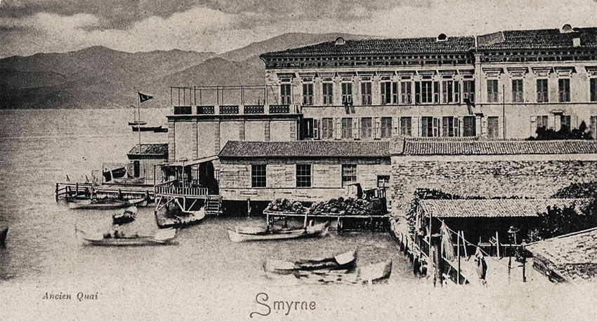
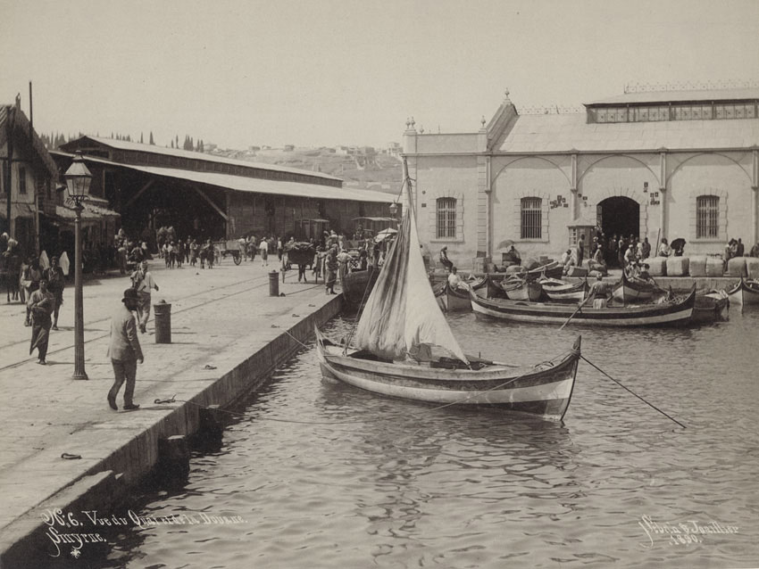
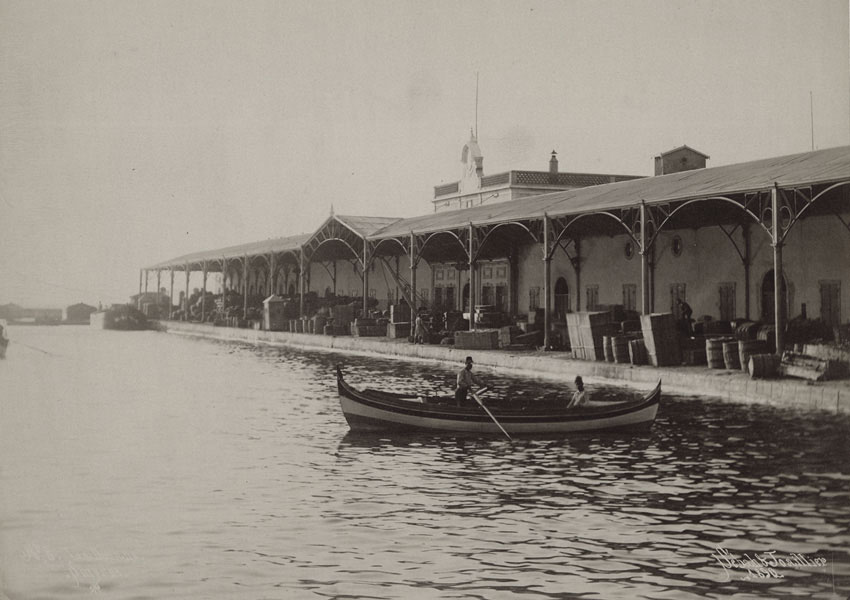
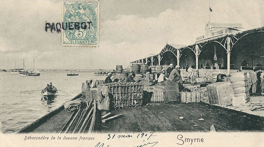
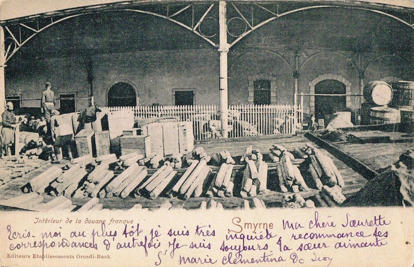
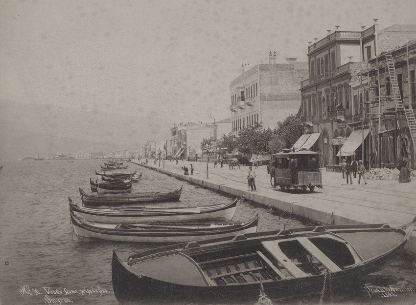
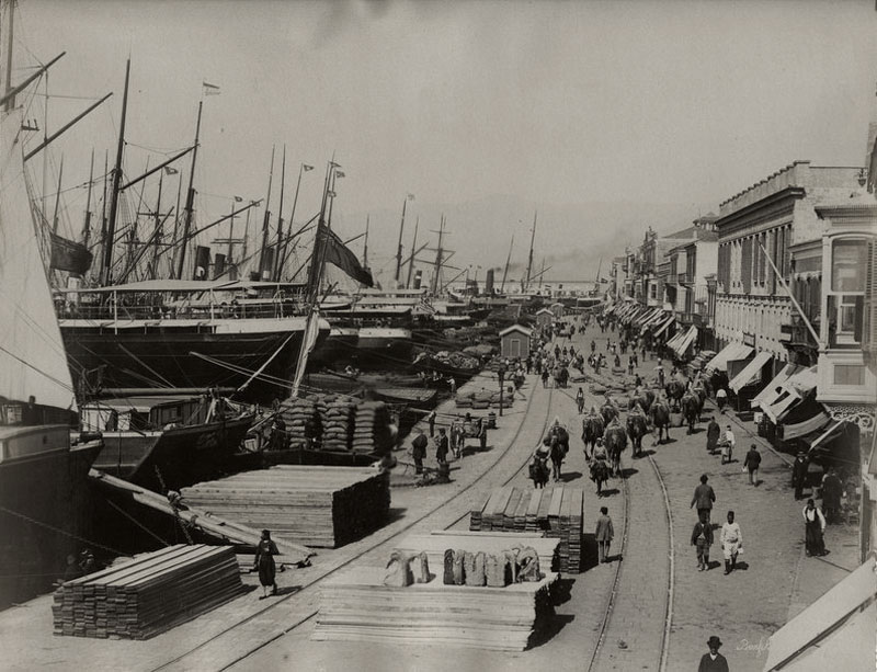
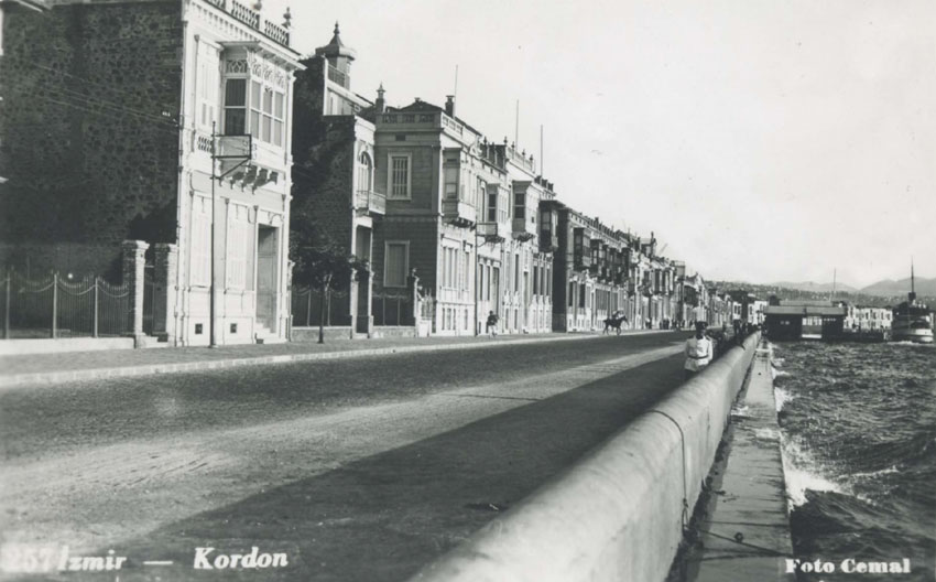
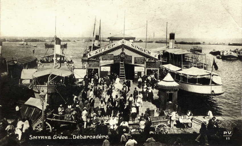
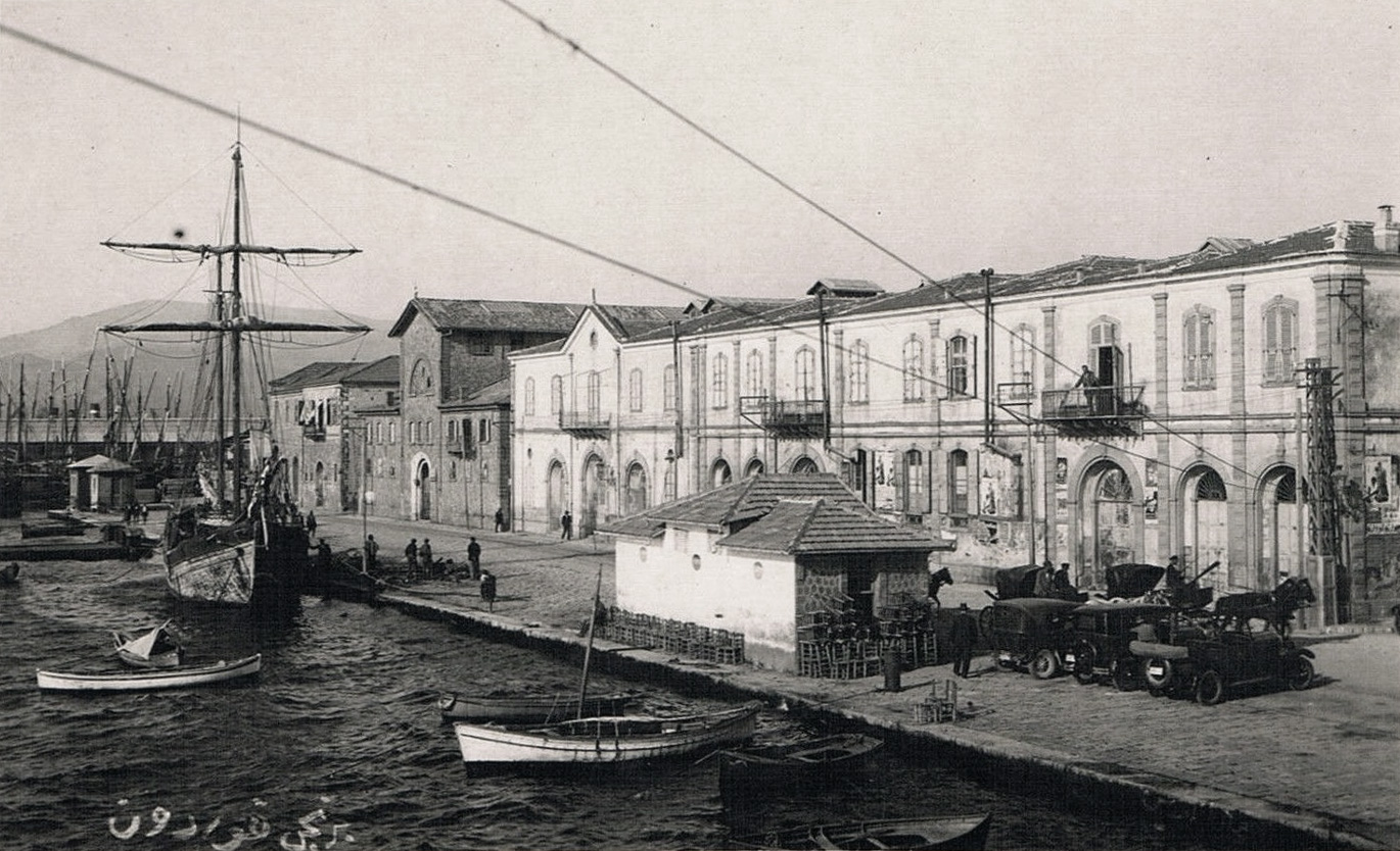
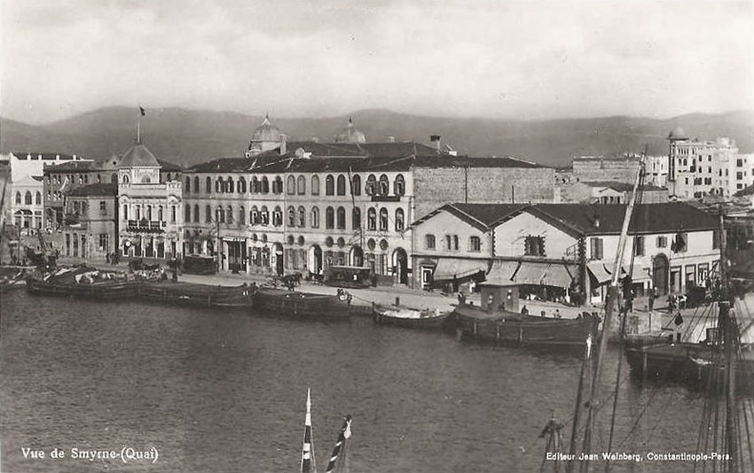
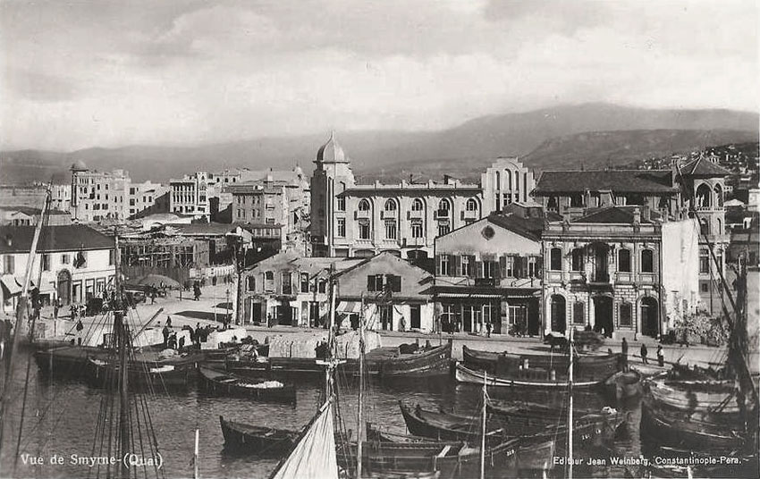
A section of the old quai (before 1869) where the Austrian Lloyd Offices were located - further info: |
|
|
|
|
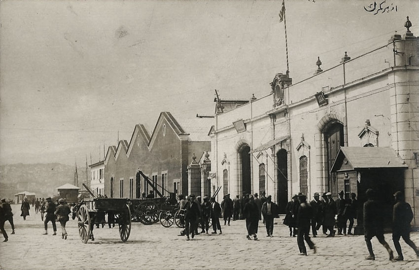
Click here for later custom’s pier area postcard views. |
|
|
|
|
|
Click here for later north of the custom’s pier postcard views. |
|
|
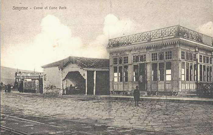
A series of photos from Constantinople based Sebah & Joaillier, 1890. Cafe Eden, that was destroyed by fire sometime around 1900. According to Katramopoulos, at about 1920 there were 2 cafes in NW Punta, the first one named ‘Corso’,
probably at the same location where Cafe Eden once was, and the second one named the ‘Luna Park’ (see below). |
|
Situated near the extreme north of the Punta pier, the Cafe de la Pointe venue was also referred as the Lunapark (to the right). The Kivetos Theatre was situated here in earlier times. To the left side of the Lunapark was situated the maintenance and repair station of the Pier trams. The owner of the Luna Park was Athanasiou Dimopoulo who had a house at Seydiköy. The Corso Cafe is probably the building visible in the distance to the left (where Cafe Eden probably stood earlier). |
|
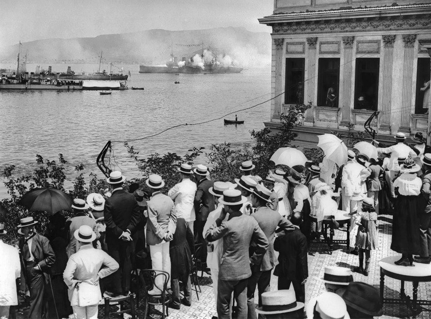
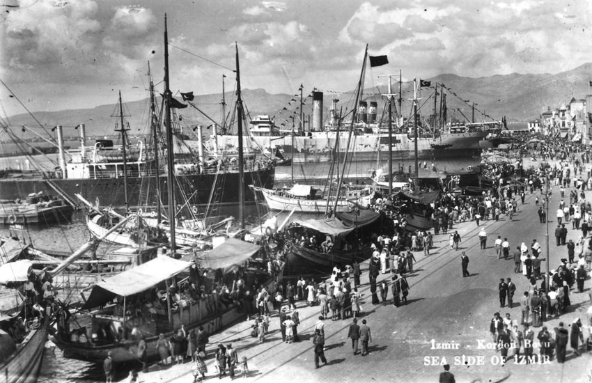
Sporting Club, 1919. The ships in the harbour could be the vanguard of the Greek invasion with cannons fired in celebration. |
|
|
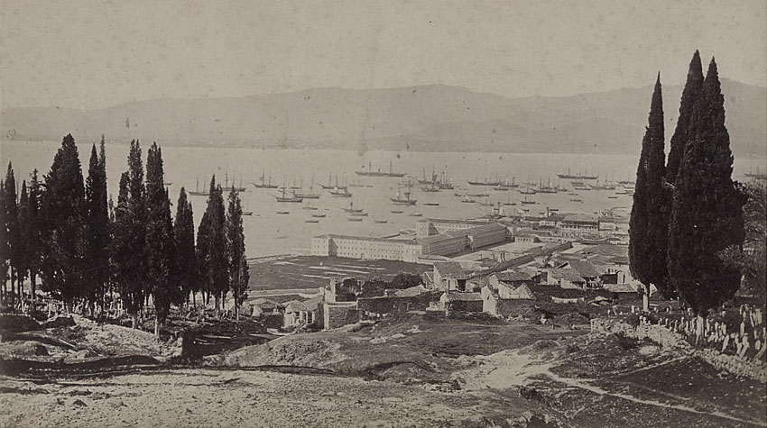
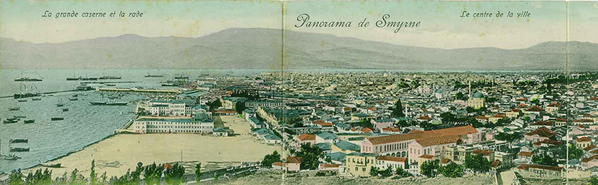
Image from around turn of century, clearly showing the Sarıkışla barracks by the sea-front of Smyrna. click image for full view |
|
|
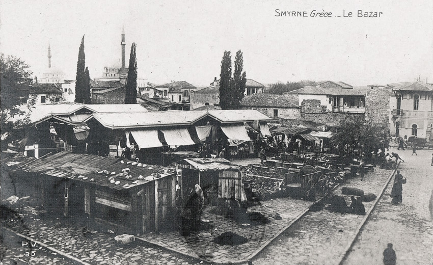
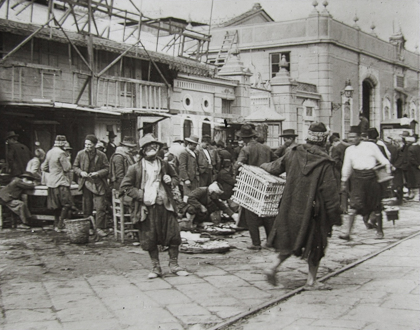
The old bazaar known as ‘Irgat Pazarı’ in the ‘Mezarlıkbaşı’ quarter neighbouring the Çankaya district as seen pre-1922. In earlier times the area was the heart of the Jewish community and the quarter was known as ‘Cavez’. The police station seen on the extreme right was built in 1913 by the city Mayor Rahmi Bey. The nearby mosque on the right is Şadirvan, the far Hisar, neither of which have their minarets today - hover for views of the location today: Anafartalar police station formerly known as Keçeciler (keçe = felt, there were felt making workshops nearby - in Greek Ketsetzidika) police station Analysis courtesy of Achilleas Chatziconstantinou & Yaşar Ürük. |
|
|
Click here for an earlier view from this angle. |
|
|
2 photos taken by Rubellin and Sons, based in Smyrna, in the 1880s. |
|
|
|
|
|
|
|
|
|
|
|
|
|
Click here for earlier south of the custom’s pier postcard views. |
|
|
The photo would have been taken soon after the removal of the horse-pulled tram tracks as seen on the road. The original Alsancak ferry jetty can be seen in the background. The palm trees are yet to be planted. I make it late 1940s- early 1950s.
I think the house in the foreground could be the Deportu house? - information courtesy of George Galdies - click here for earlier date images of this district. |
|
|
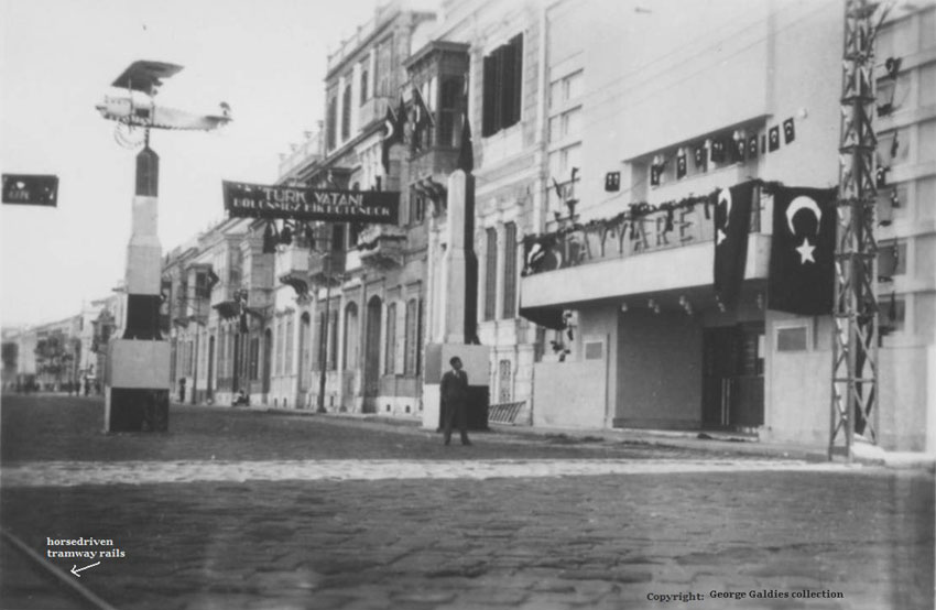
The photo would have been taken shortly before the removal of the horse-pulled tram tracks as seen on the road, late 1930s-1940s. The former Tayyare [airplane] cinema, now occupied by an apartment building, I believe called Tayyare Apartmanı. - information courtesy of George Galdies. |
|
|
|
|
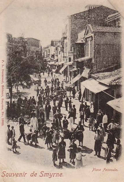
Fassoulas was a square in the European district of Punta, from which started the Trassa street that went north-northeast. It probably took that name either from a bean field (bean = fassouli in Greek) or the open air greengrocery market located there. It was celebrated in Greek folk songs for the temper of its inhabitants, men and women, somewhat defiant yet modern - hover here
for a location map - analysis and information courtesy of Achilleas Chatziconstantinou. |
|
|
|
|
|
|
|
|
|
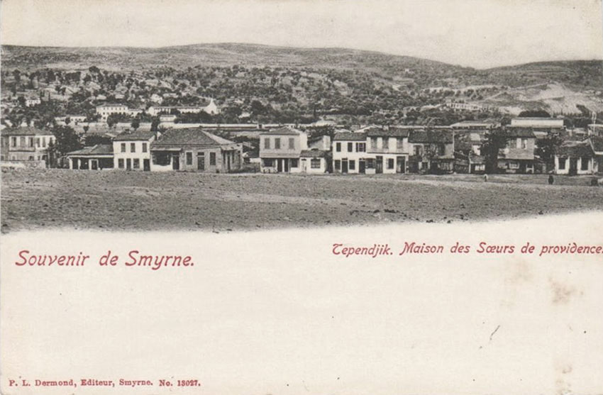
The view of “Tependjik” is in fact Tepecik (district beyond Kemer), the French Nuns’ orphanage is the “Kula des Filles de la Charite” the buildings you see at the background on the left - click here for a drawn image of this building. The French Brothers also had a ‘Kula’ further up into the valley, more towards the north (left) today’s Altındağ area I think. - information courtesy of George Galdies - |
|
|
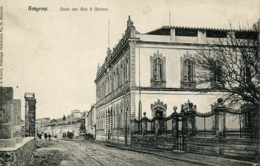
L’ecole des Arts et Metiers was Mithat Paşa Güzel Sanatlar Okulu [Fine Art Academy], don’t know if still active. The building is still standing, situated on Mithat Paşa Caddesi, Karataş - information courtesy of George Galdies. |
|
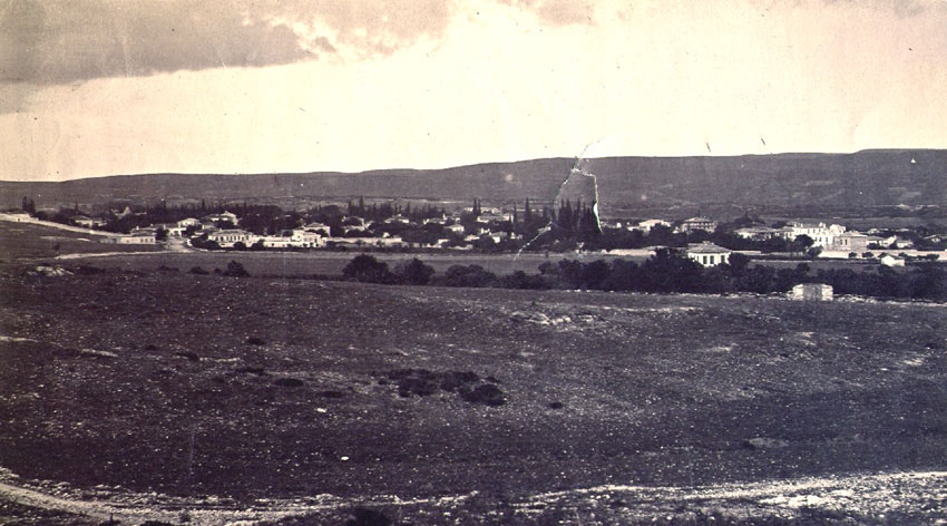
A view possibly of Buca |
|
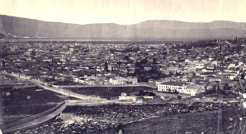
This appears to be taken in Smyrna, possibly looking down
from Değirmen tepe (corresponding to modern upper section of Varyant).
According to Cenk Berkant this photo must have been taken pre 1850-1 as
the first Moslem hospital of the city, Gureba-i Muslimin (based
on the dates in Ruchan Bubur’s “Izmir Gureba-i Muslimin hastanesi”
article), is not visible.
Clearly the
above pair of photos were not taken by Brian de Jongh (1912-1977) himself,
but possibly handed down from his maternal (through Dora Purser married
to Henry Richard de Jongh) grandfather, Edward Purser (1821-1906) chief
engineer and general manager of Smyrna-Aidin “Ottoman” Railway. Source Brian de Jongh through Edward de Jongh - a somewhat later view from this hill below. |
|
|
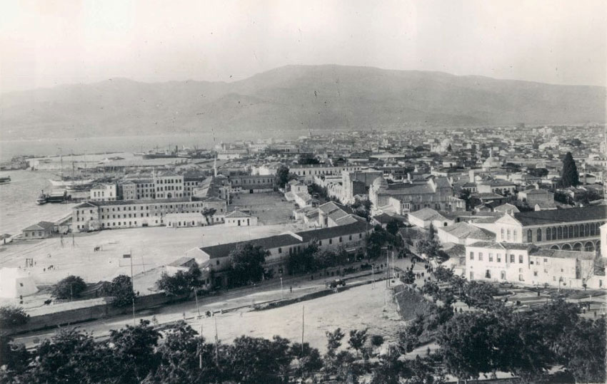
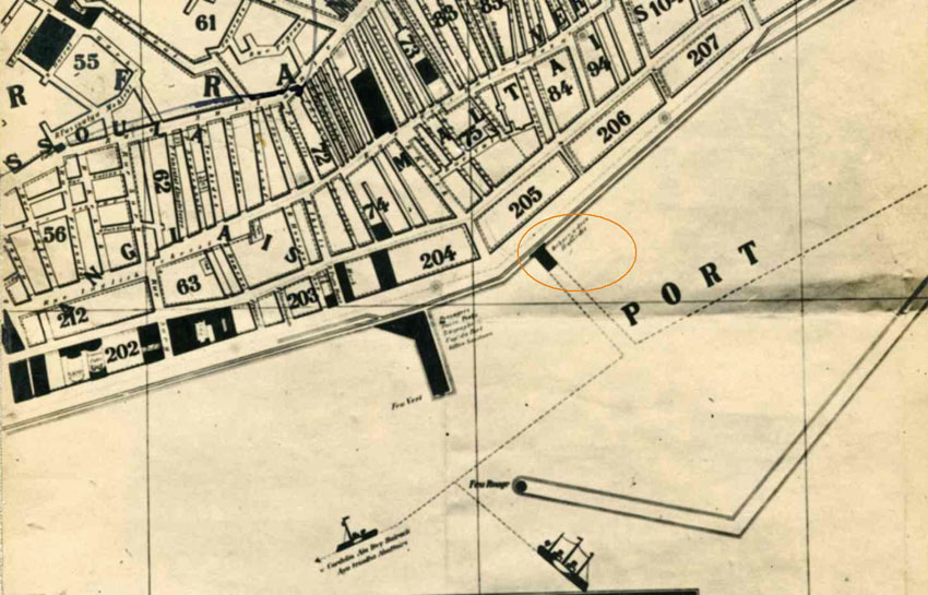
The above image appears to be taken south of the custom’s pier (so Pasaport zone rather than Alsancak / Punta), within the breakwater that can be seen in background of the photo, and almost certainly the pier location shown in the map below. This was part of the private “Hamidiye” Company network that had piers right across the bay of Izmir (Cordelio, Alabey, Osmanzade, Turan, Bayraklı, Pasaport, Konak , Military Hospital, Karataş, Karantina, Göztepe, Reşadiye). |
|
|
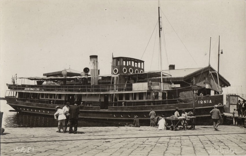
Appears to be the same Pasaport pier as above |
|
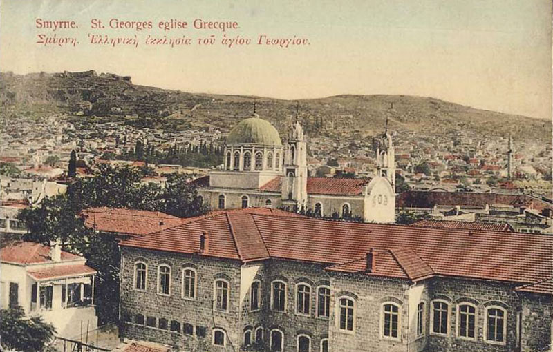
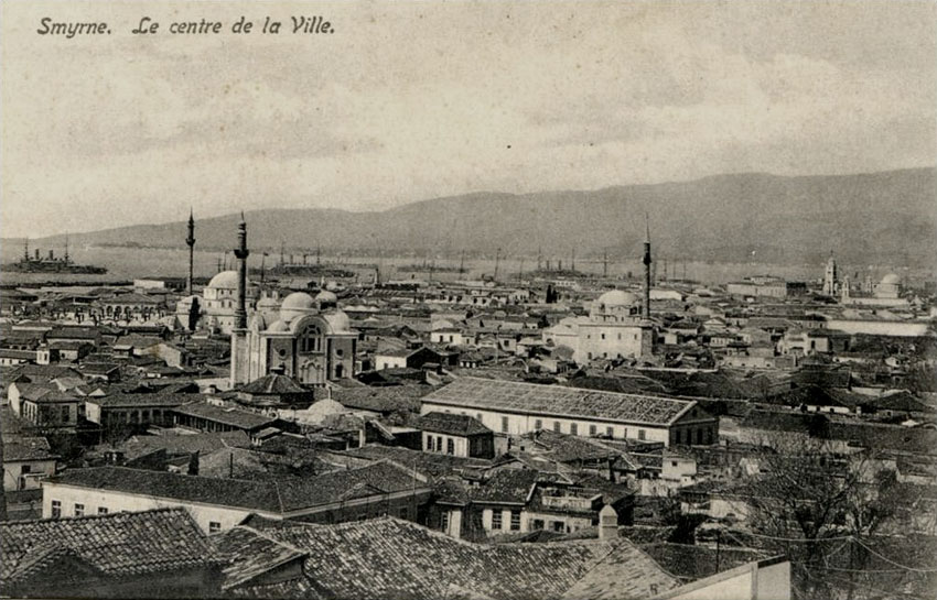
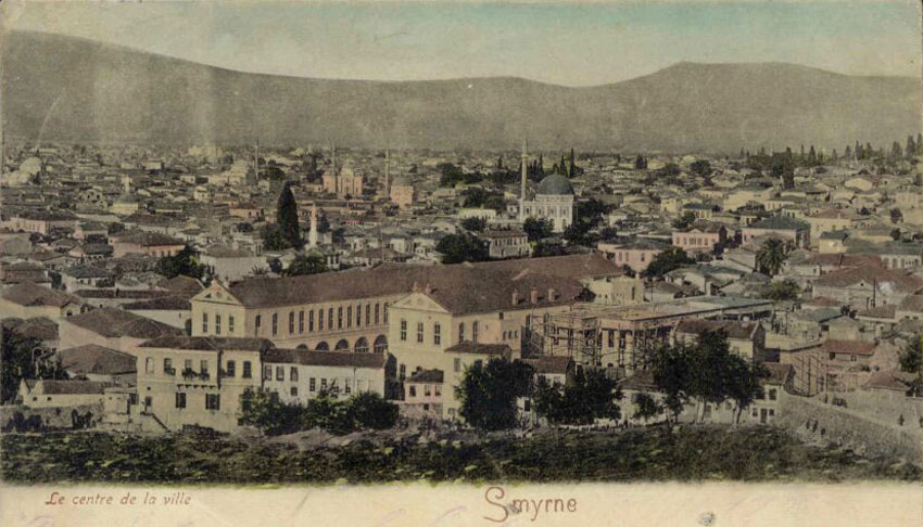
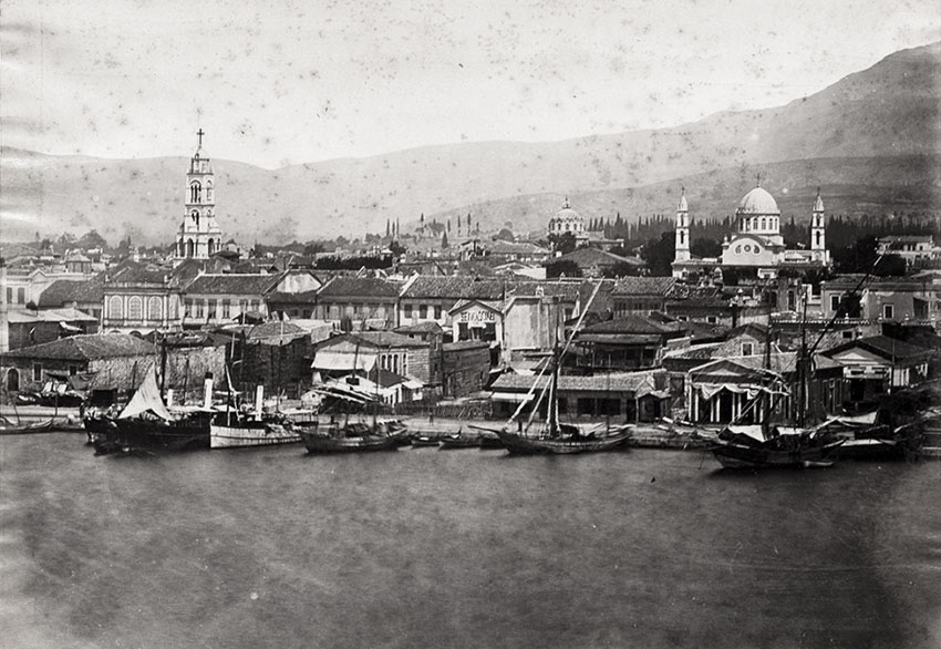
A pre-1922 view of the Smyrna seafront with the Orthodox church of Aya Fotini on the left, in the middle the old Evangeliki School and to the right Agios Yorgios (St George) Church (this order is mentioned by Prokopiu in the book Seriani stin Palia Smirni). The Smyrniot architect Efstration Kolonaris is the architect of the bell tower of Aya Fotini
(1856) and of St George. (Source: Smirneika Hronika - Smyrnean Chronicles). |
|
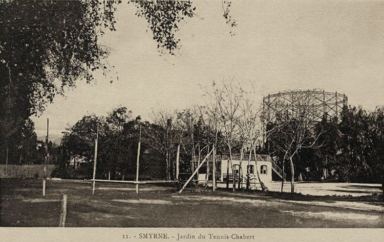
The tennis courts possibly near Rue Chabert (now named 1468 Sokak, parallel to Rue Bournabat) in the Punta zone, not far from what look like gas towers. |
|
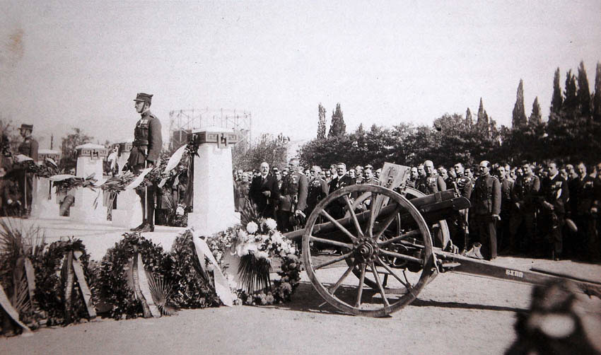
A memorial service at the Panionios Stadium in the autumn of 1921, for the fallen in the battle of Sangarius [Sakarya]. The Greek High Commissioner Aristidis Stergiadis and the Commander in Chief of the Greek Army general Anastasios Papoulas are visible in the middle. Just above them and to the left is the cylindrical structure of the gas works, and behind the people to the right is the cypresses belonging to the Greek Cemetery. |
|
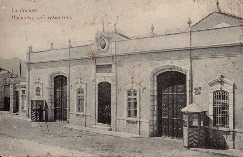
The old Smyrna Customs House, exact location possibly the French Pier, now known as Konak Pier. |
|
|
|
|
|
|
|
|
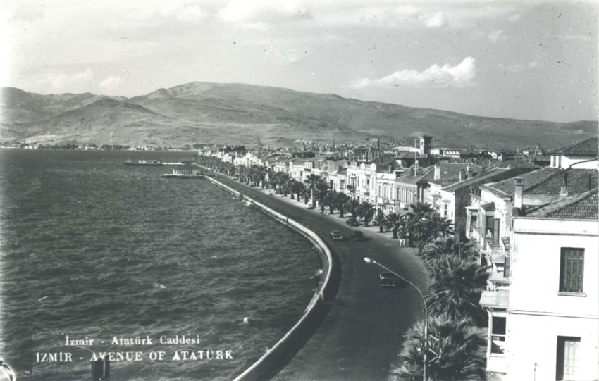
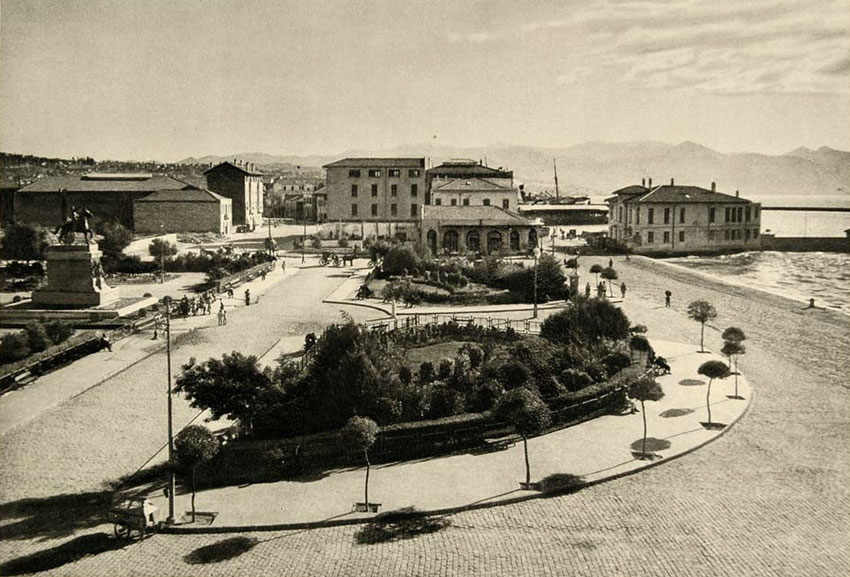
A photogravure by Otto Lachs of the Ataturk square near Pasaport, Izmir from 1937. |
|
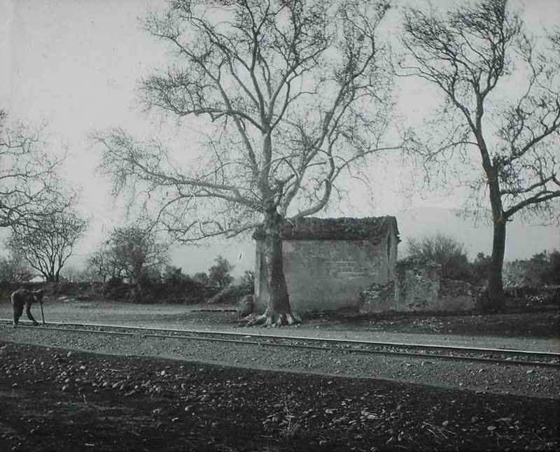
Railway line maintenance near Bournabat. |
|
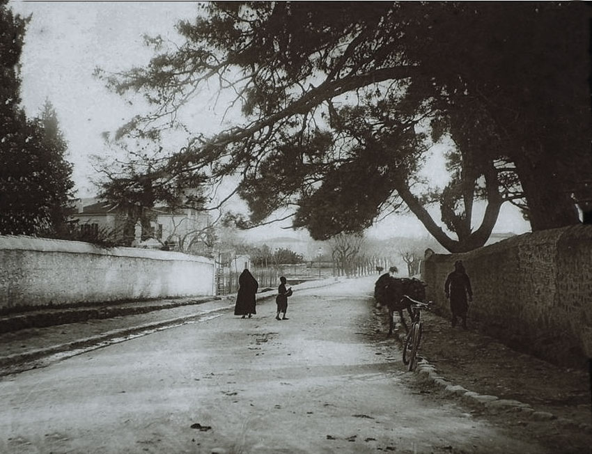
Bournabat. |
|
Bournabat. |
|
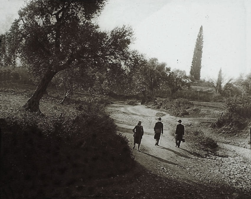
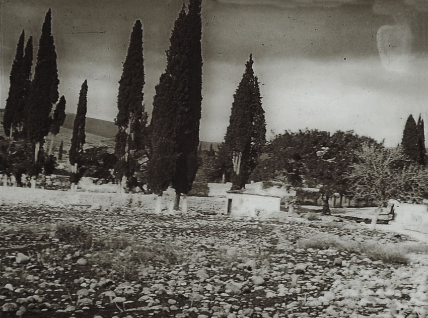
Cemeteries of Bournabat. |
|
|
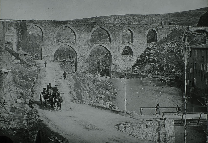
Pair of shots of the St. Anne’s valley [ Yeşildere] passing the Roman aqueducts and nearing Little Paradise [Kızılçullu]. |
|
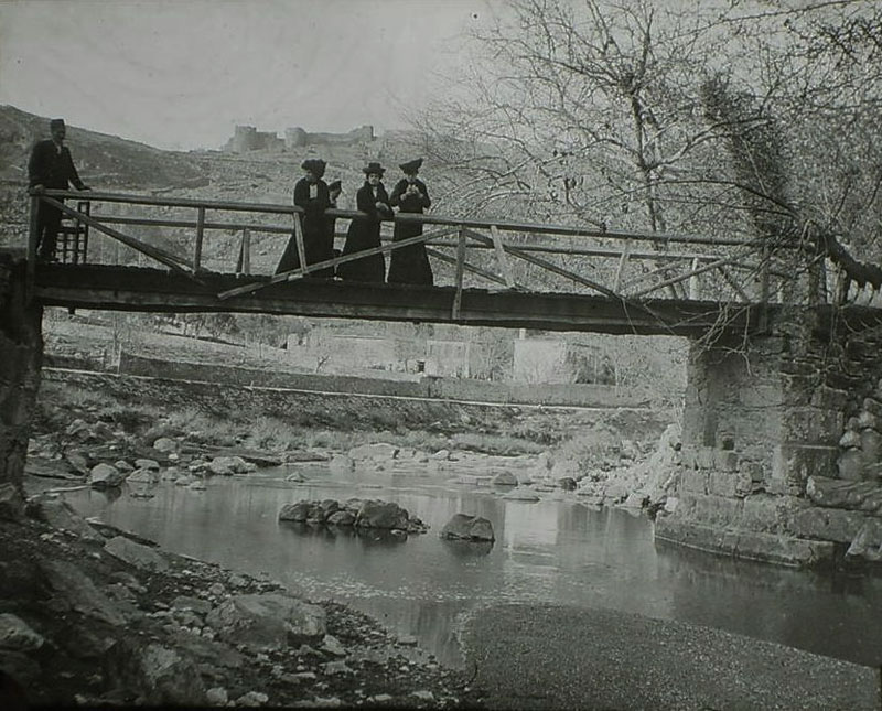
Bridge over the Meles river on St. Anne’s valley a bit beyond the Profitis Ilia monastery. |
|
|
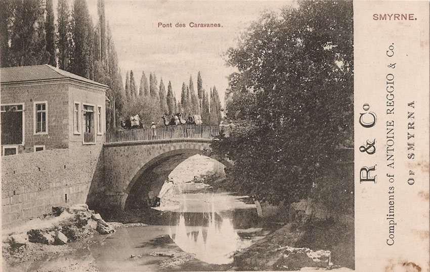
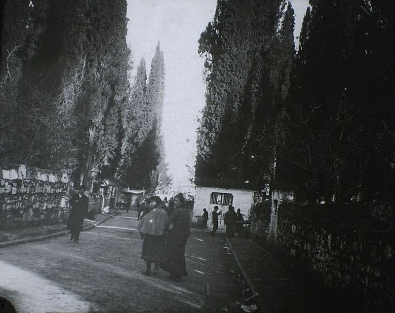
Caravan Bridge cemeteries area. |
|
|
|
Kokaryalı. |
|
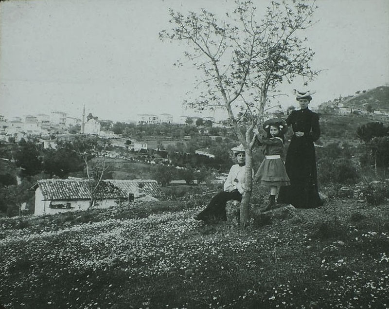
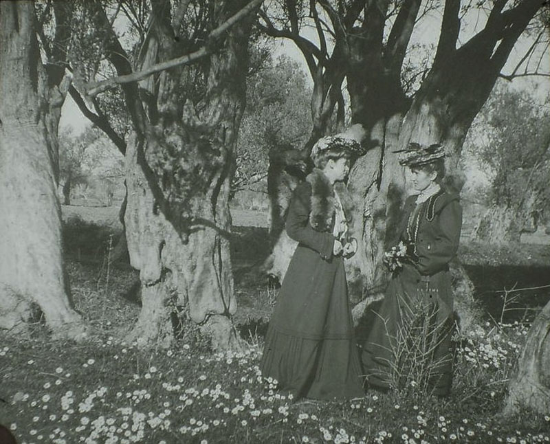
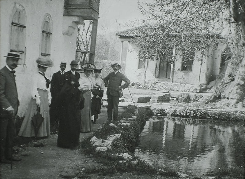
Pınarbaşı (Bounarbachi - approx 4 km. SE of Bornova). |
|
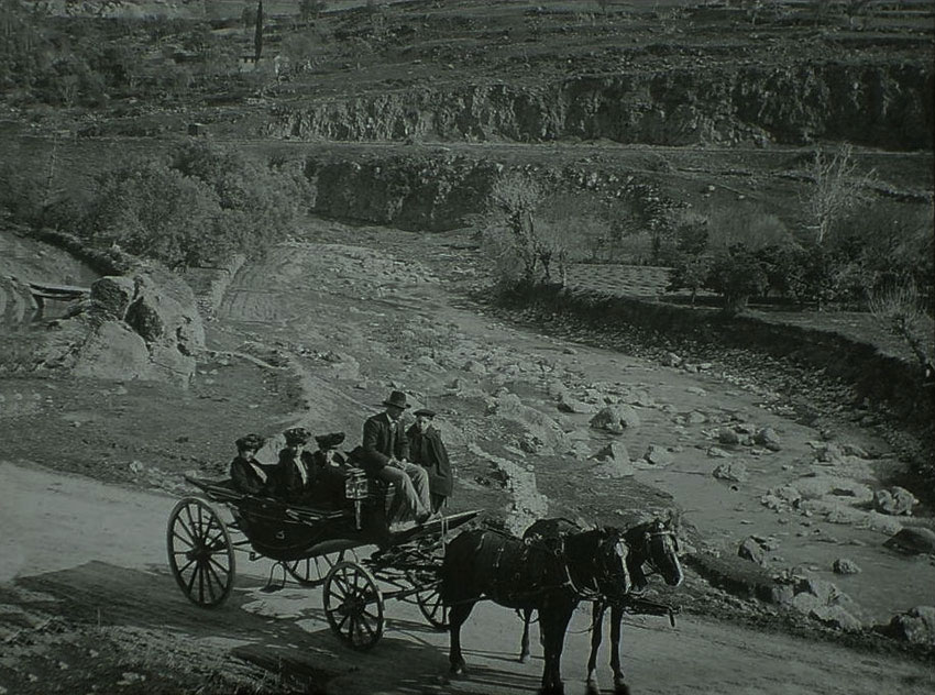
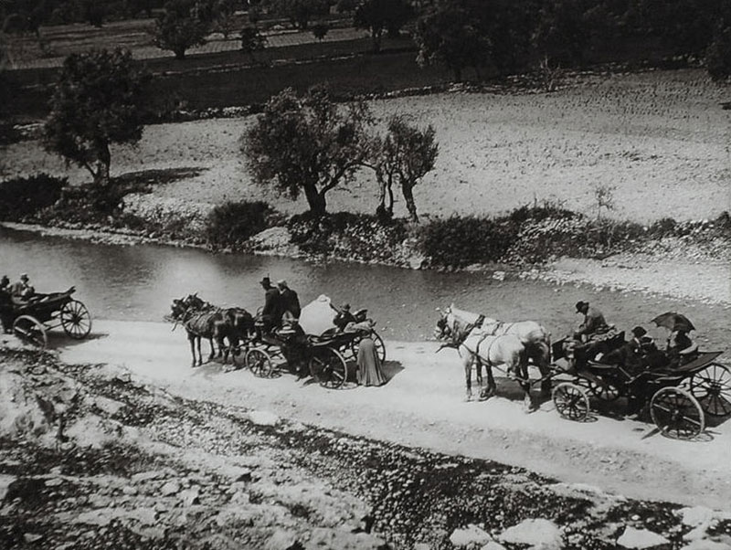
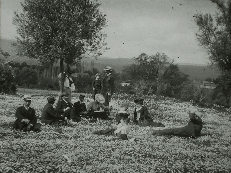
A pleasure ride in Pınarbaşı. |
|
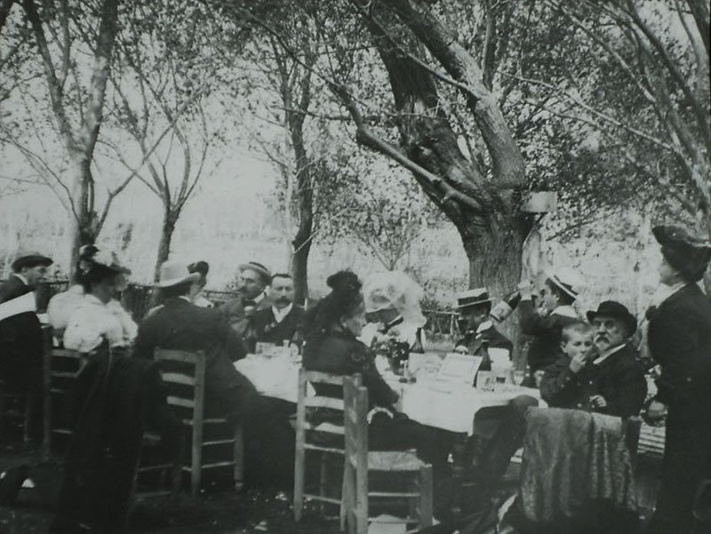
A Levantine group meal in Pınarbaşı. |
|
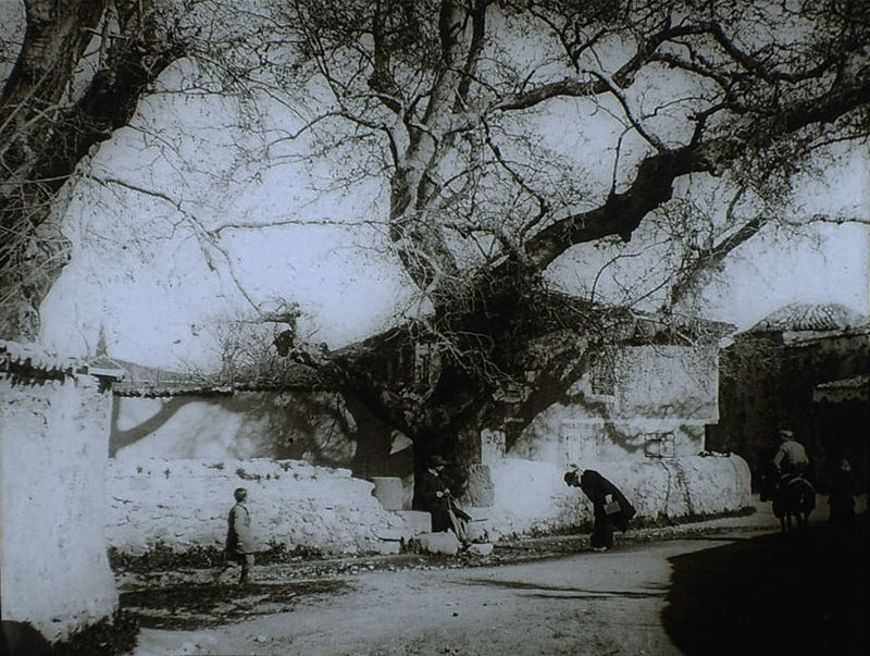
Pınarbaşı. |
|
Pınarbaşı. |
|
Pınarbaşı. |
|
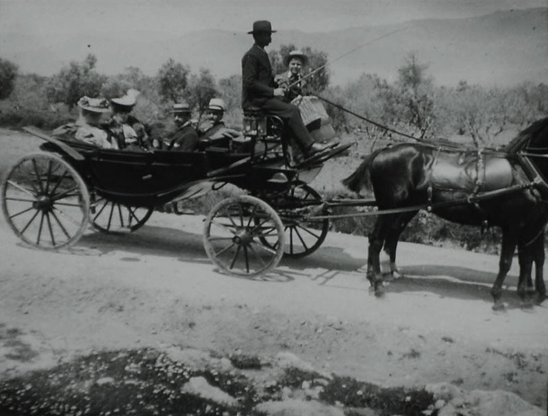
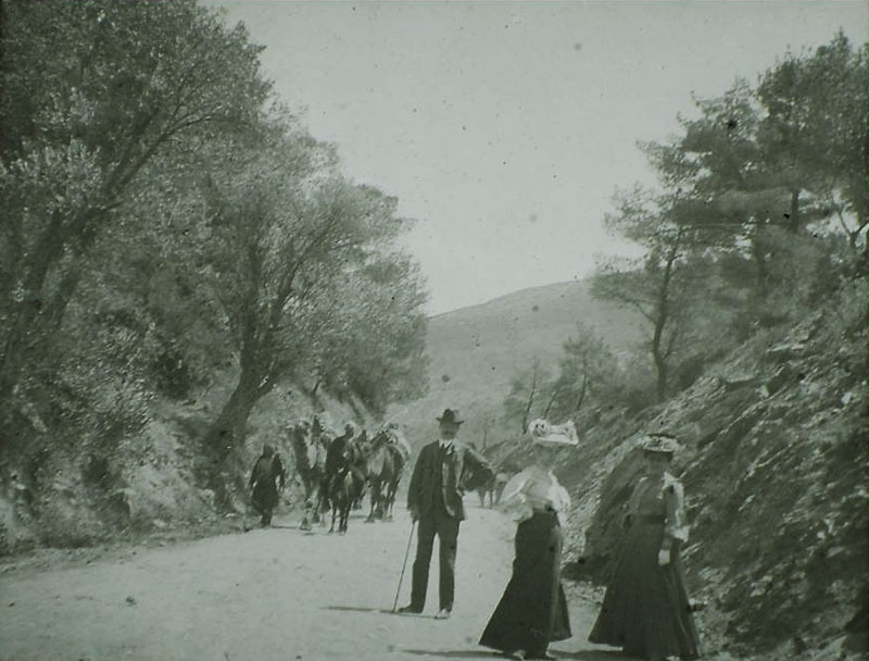
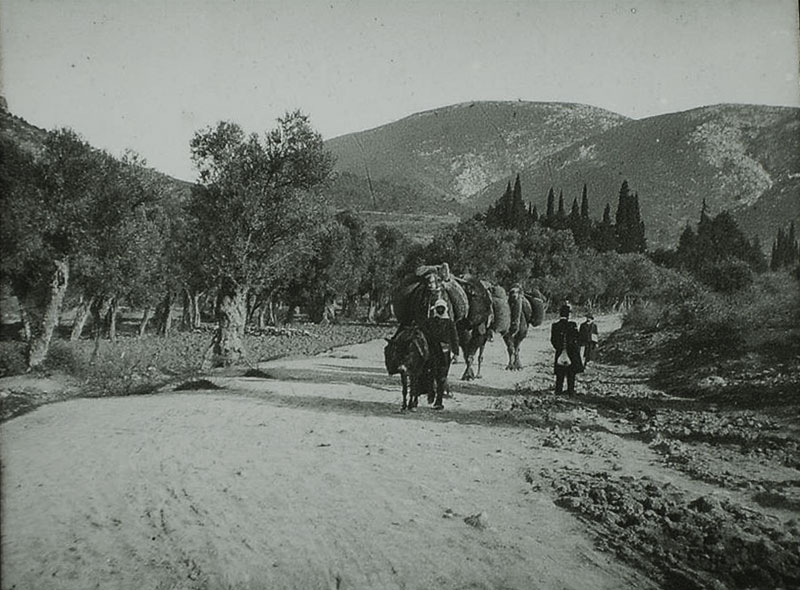
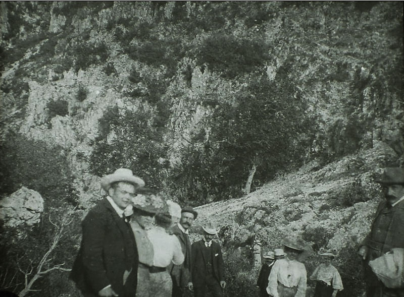
Route to Nymphio [Kemalpaşa]. |
|
Route to Nymphio. |
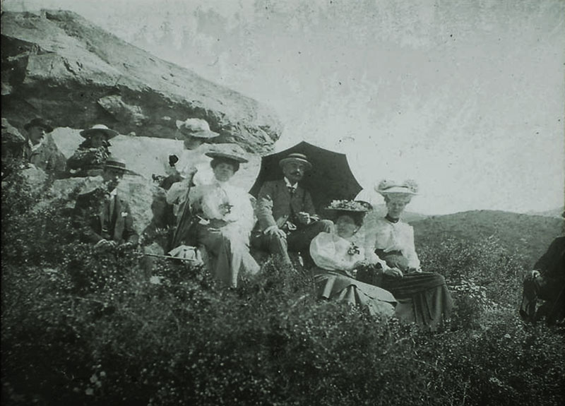
|
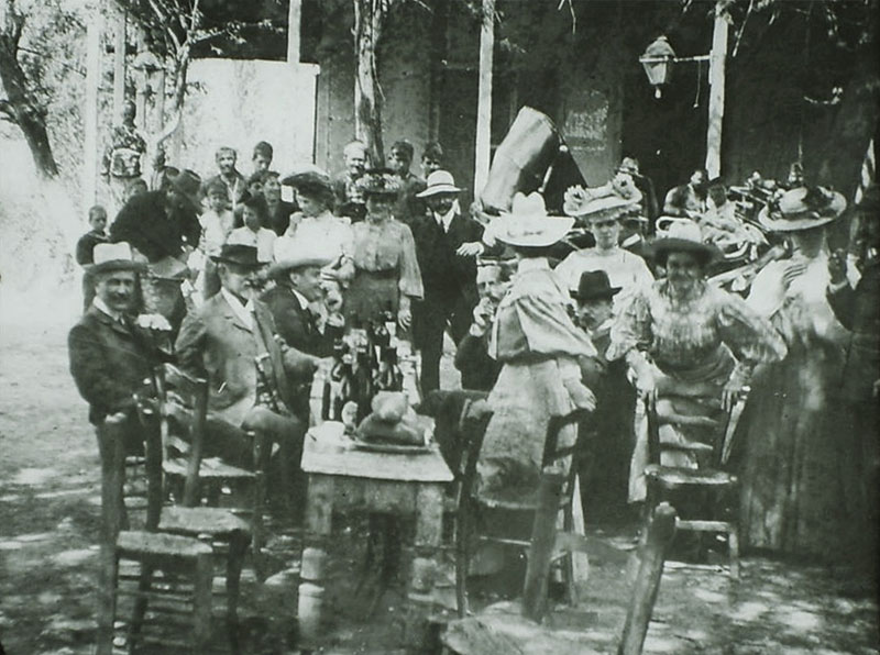
Lunch at Nymphio. |
|
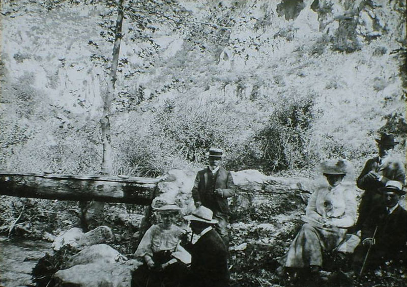
Ravine at Nymphio. |
|
Ravine at Nymphio. |
|
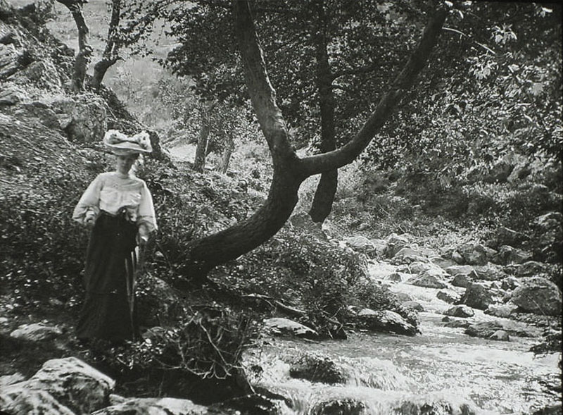
Gorge at Nymphio. |
|
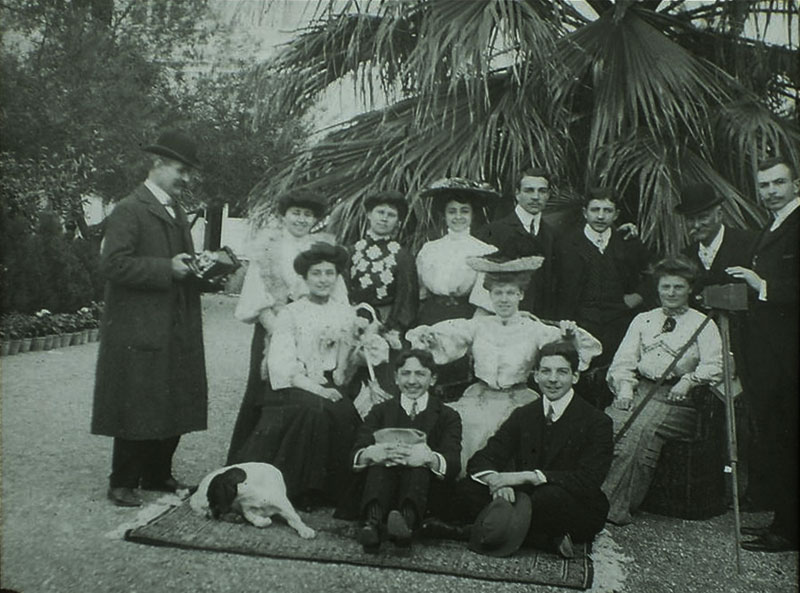
Excursion to ‘Chiftlik Saint George’. |
|
Local amateur dramatics: ‘actors of the Pagus Revue’ - 1904-5. |
|
Some of the actresses of this group. |
|
|
|
|
|
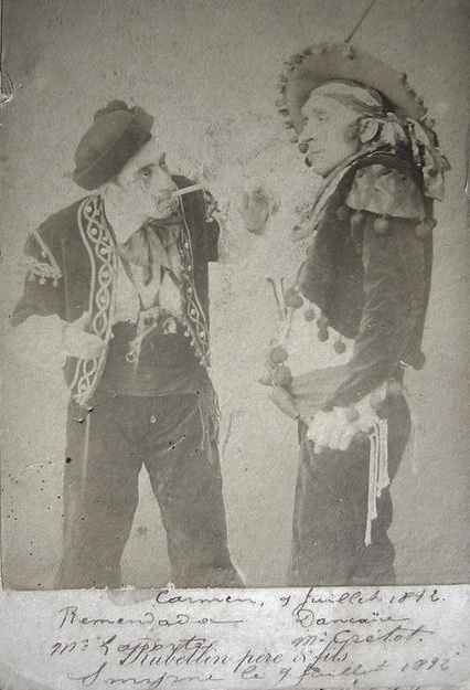
As written on the bottom of this photo, Bizet’s Carmen was performed in Smyrna on July 9, 1892 by a travelling foreign (perhaps Italian) opera troupe. A cabinet photo by Rubellin, taken at his Photographie Parisienne studio on Rue Franque, Smyrna, shows troupe singers Remendada Lapporte as the glamorous torero Escamillo (left) and Dancaïre Grétot as Don José, the naïve soldier who is seduced by the wiles of the fiery gypsy Carmen (right). These performers names have been lost to history and it is not clear which theatre they performed in, possibly Smyrna Theatre on the waterfront, built by Charles Missir.
|
click for image galleries of archive views of neighbourhoods of Smyrna:
Punta | Bella Vista | Boudjah | Bournabat | Cordelio | Karatas | Göztepe
|
 |