Ephemera
The former Caravan Bridge cemeteries of Smyrna
The Caravan Bridge (Kemer) area just outside the old city limits of Smyrna / Izmir was the communal graveyard for the various communities of the city, and with the expansion of the city these were progressively destroyed - Armenian in the 1920s, Anglican, Catholic, German, Dutch, Austrian ones, late 1970s, early 1980s. Few tombstones have survived, for example the surviving but vandalised Dutch tombstones are displayed in their smaller older cemetery in Alsancak, moved in 1965. Currently only the Jewish one survives. Photographs of these lost cemeteries are extremely rare.
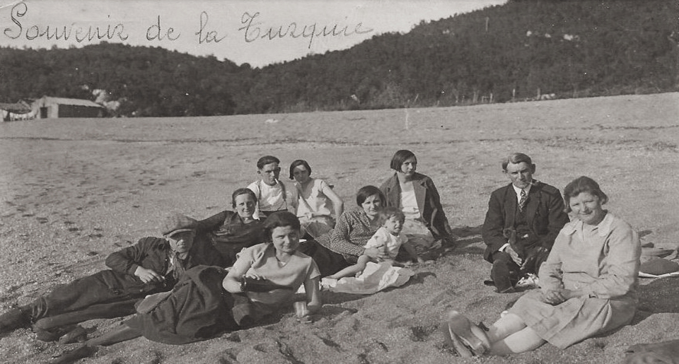
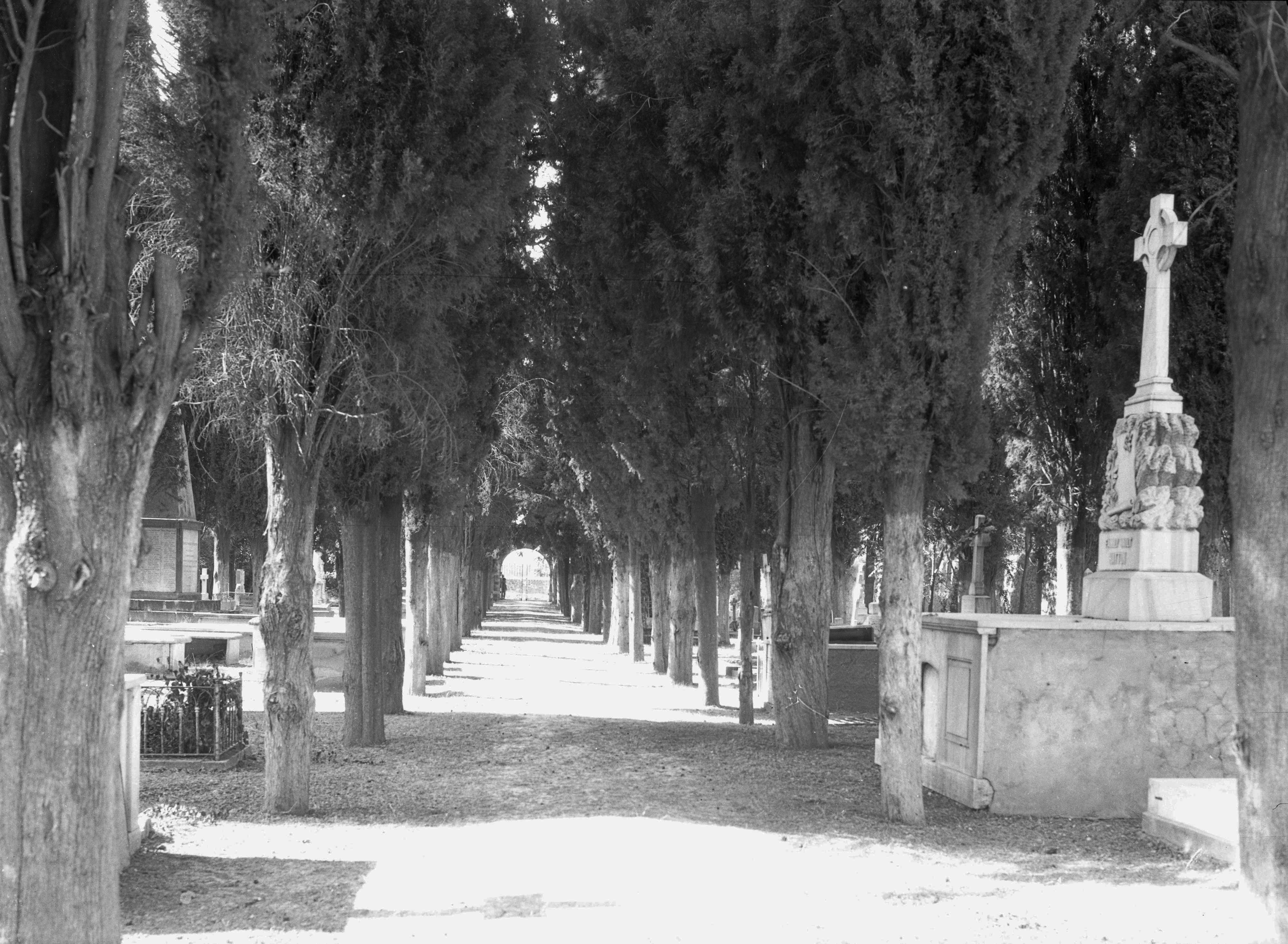
This set of photos show the former Anglican cemetery tombs but no indication of who took the photos but they were deposited in the archives of the Bornova St Mary Magdalene church and within an envelope cover pencilled in as ‘Kan-Çeşme Cemetery’, found by Brian Giraud in 2019 in a basket documents from 1933 and scanned by Mark Giraud in 2021. The negatives are large format, so it would be reasonable to assume that they were taken before the gradual transition to 35mm film after WWI. Hopefully this gallery will prompt others to come forward for additional images of any of these cemeteries for their historical and genealogical value.
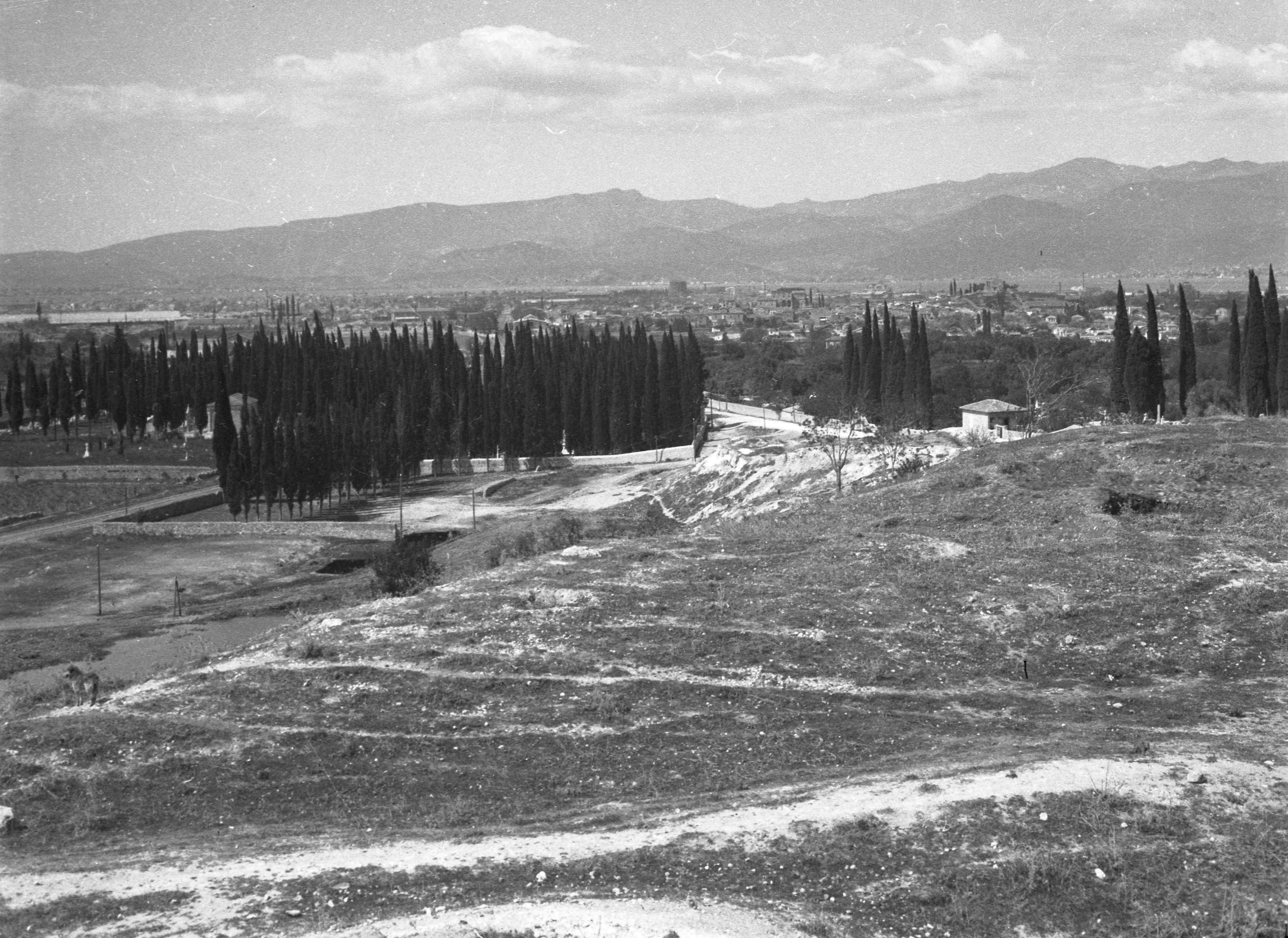
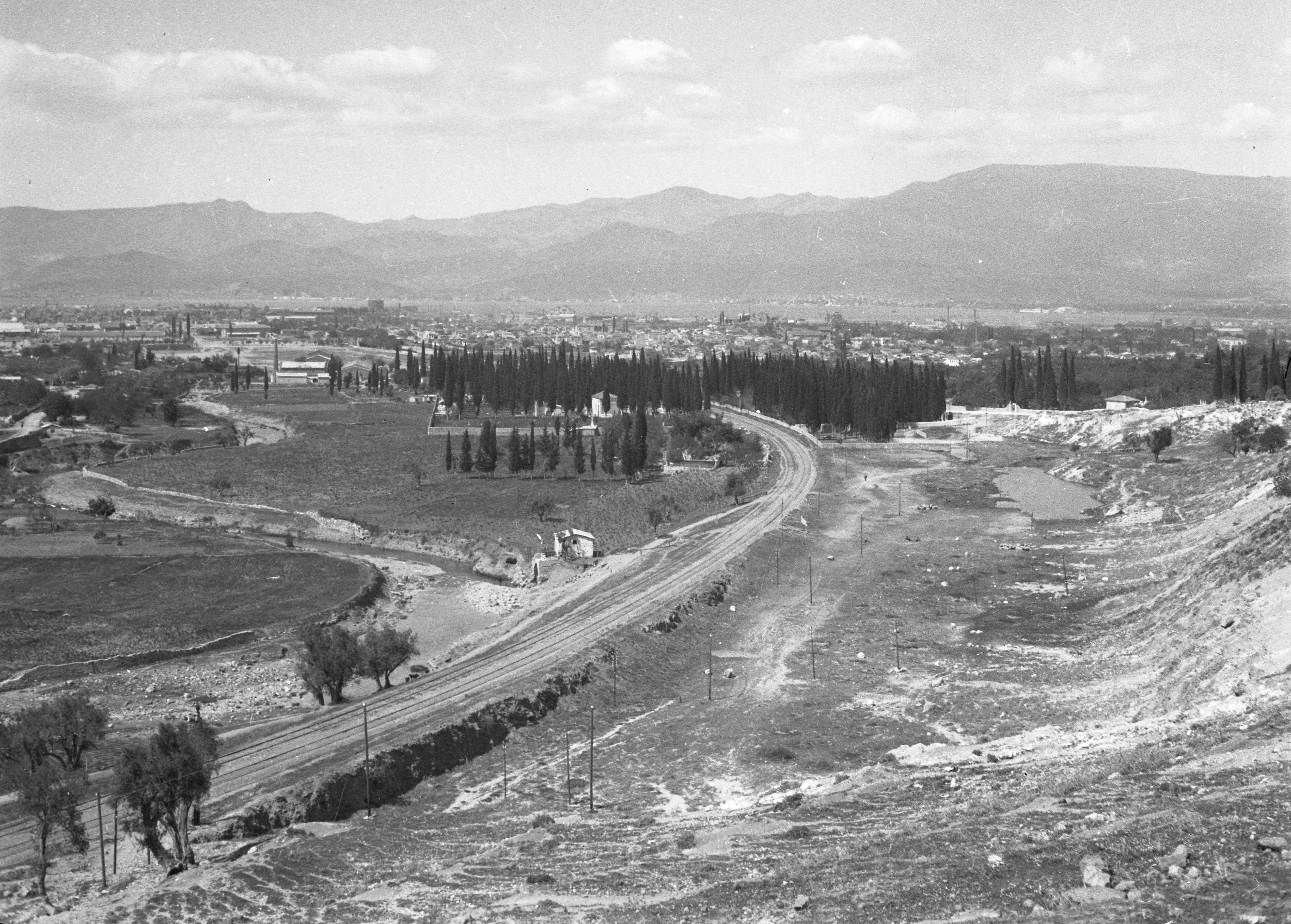
The middle cemetery marked by the dense cluster of cypress trees may be the Anglican cemetery, possibly behind a minor cemetery (Dutch?). The cemetery to the left (on the opposite side of the railway line) may be the Catholic cemetery as suggested by the temple like and large tombstones there. The wall and entrance (right on the edge of the image) beyond the road is likely to be the Jewish cemetery which still survives till today.

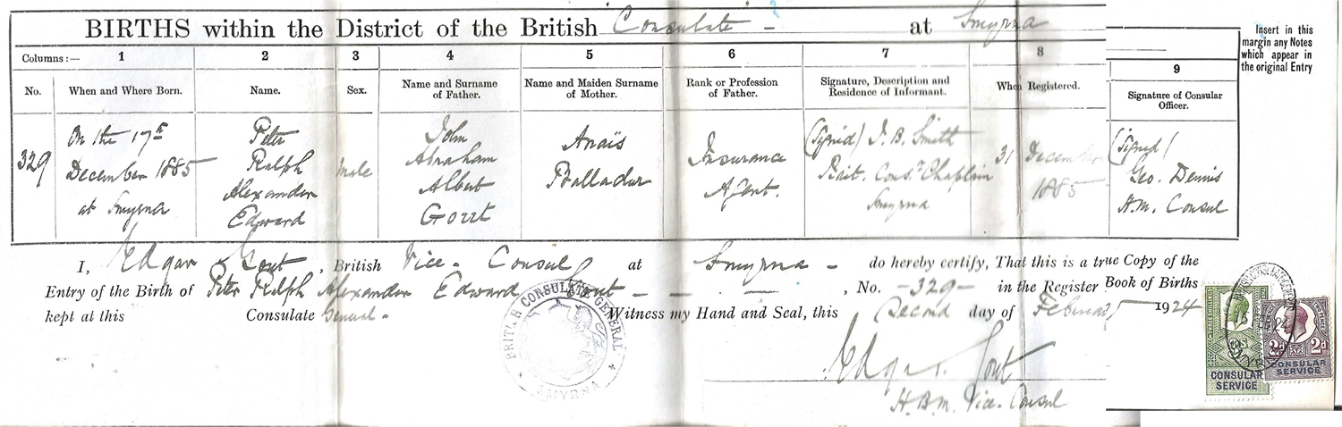
The tombstone with minor damage visible near the wall has the inscription ‘Sacred to the memory of John A.A. Gout, born 04 September 1854?, died 27 July 1---?’. This person was probably John Albert Abraham Gout, married to Marian nee de Jongh and they had 5 children, view family tree:
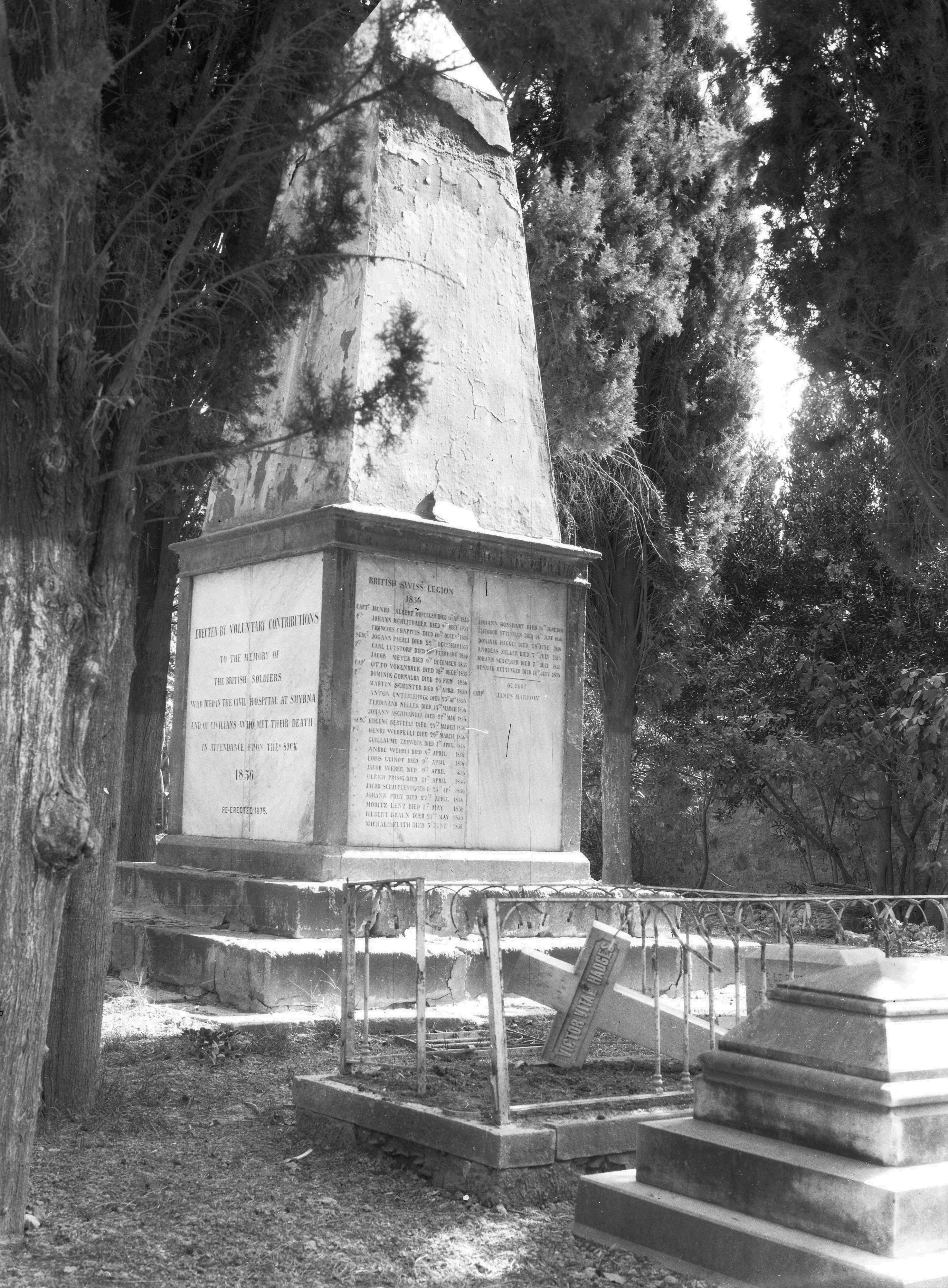
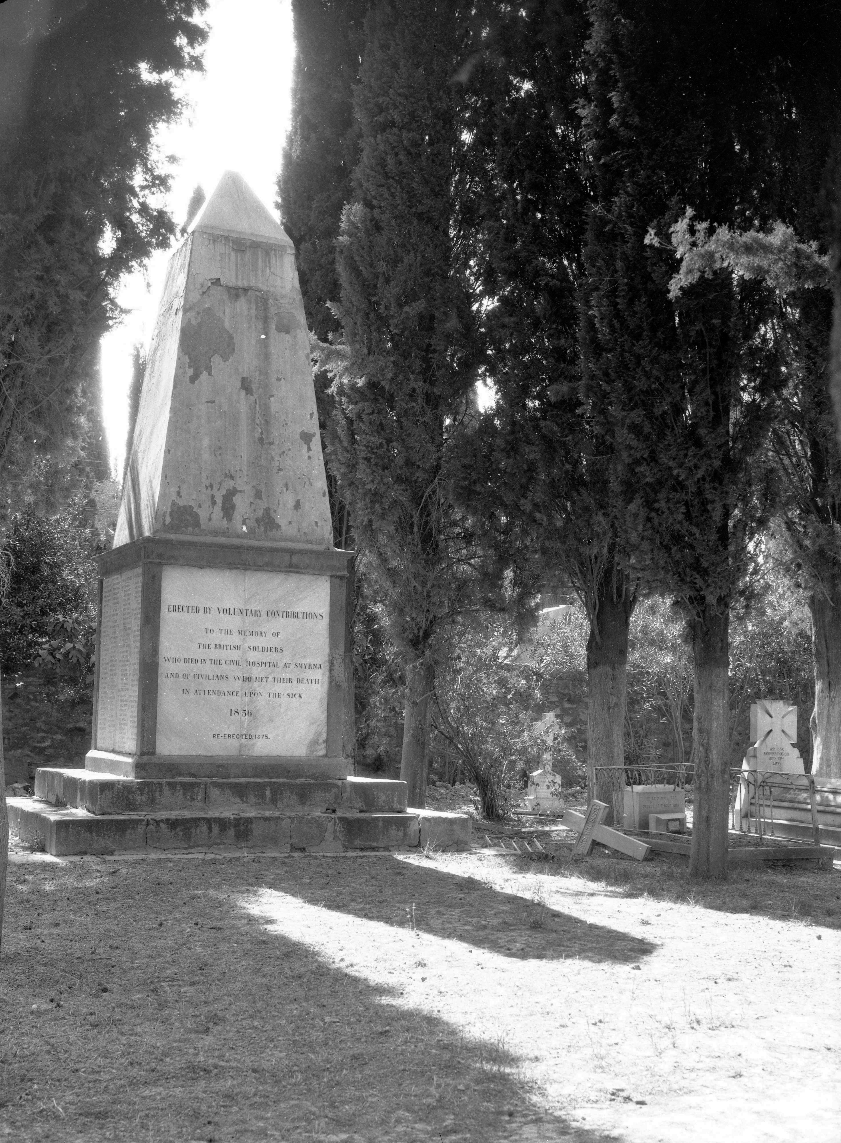
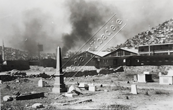
The caption on the base of this obelisk ‘Erected by voluntary contributions to the memory of the British Soldiers who died in the civil hospital at Smyrna and of civilians who met their death in attendance upon the sick - 1856 - re-erected 1875’.
The other face: ‘British Swiss Legion, 1856’ - 31 names.
The closer broken cross grave inscription: ‘Victor Vital Hadges’
Additional information courtesy of Mike Hinton: There was a British Military Hospital at Smyrna from February to November 1855. Of 1887 admissions 154 died. For most of the time the medics were civilians though the army was responsible for discipline etc. The premises was then taken over by the British Swiss Legion about which little documentary evidence has seemingly survived.
The good state of the memorial suggests the photo was probably taken within a few years post re-erection in 1875 - The cemetery was visited by Brigadier Ayde, RA in November 1872 when he and Colonel Gordon (later of Khartoum fame) surveyed the British Military cemeteries in the Crimea and Turkey. The relevant report section is visible here: The reference is House of Commons Parliamentary Papers 1873 (C.719) XL.433: Report on the Crimean Cemeteries. Additional information courtesy of extract from Hinton, M., Victory over Disease. Resolving the Medical Crisis in Crimean war, 1854–1856, (Warwick: Helion, 2019), 105–11 - image:
The photo below from Greek sources has the caption of the Italian cemetery of Smyrna, and its surroundings doesn’t correspond with any of the existing Catholic cemeteries today, so perhaps this was the Italian section of the Catholic cemetery of Kemer? More information on this cemetery:
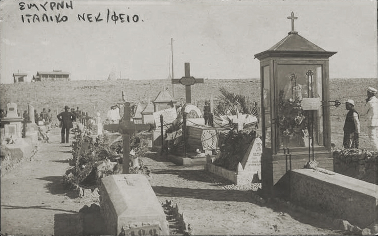
The hand-written caption description style does not correspond to the age of the photo so therefore designation of Smyrna is suspect. The pair of wooden plaques visible on the ends of nearby tombs suggests at least these were military in nature. The fresh palm fronds and the milling crowd suggests an upcoming ceremony or an arrival. The top isolated building suggests a railway line running along the ridge on the horizon but that steep high earth bank doesn’t allign with the general lie of the Kemer zone.


Pair of 1964 dated photos of the former Anglican Cemetery of Caravan Bridge showing high level of vandal damage and upper photo graves possibly of the Barkshire family.
1974 dated photo of the former German (military?) Cemetery of Caravan Bridge with the Kemer railway station in the background. The central obelisk is perhaps for the WWI dead?
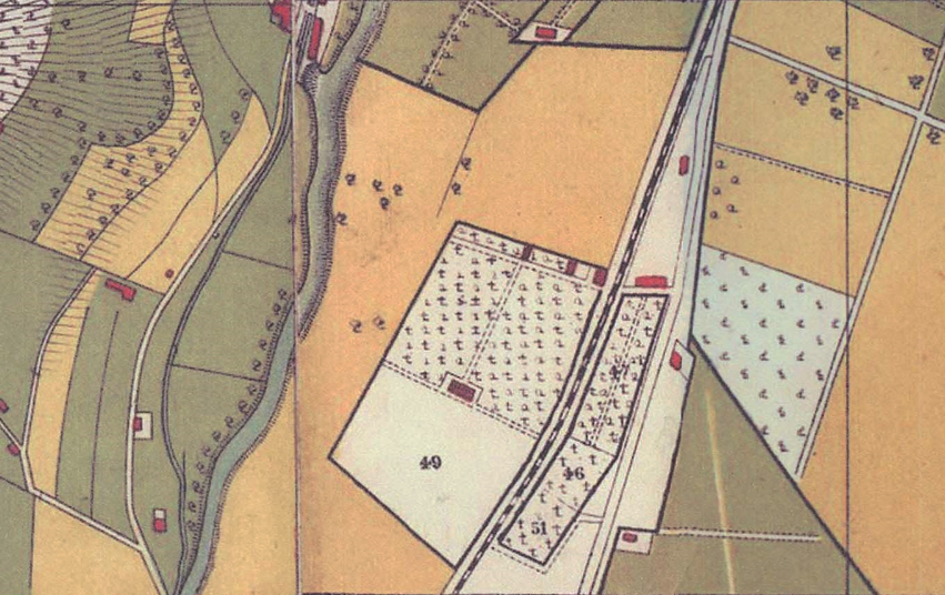
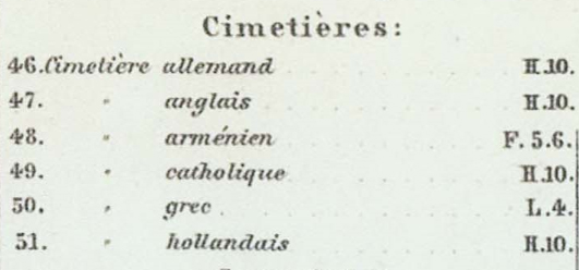
Close up of an edge section of the Lamec Saad map of Smyrna from 1876, showing the position of the minor Dutch and German (presumably Protestants of that nation) cemetery grounds to the south of the Anglican cemetery and also the more substantial plot of the Roman Catholic burial ground to the west beyond the railway tracks. It appears the Jewish cemetery was not established by this date and also no sign on the map of the German military cemetery (?) near the railway station as would be expected if it were established shortly after WWI.

Current (2017) view of the partially vandalised Jewish cemetery of Kemer.

Current (2017) view of the location of the former Anglican cemetery of Kemer, used by the municipality as a refuse vehicles parking lot.

Current (2017) view of the location of the former German / Dutch cemeteries of Kemer.