Social institutions | Bornova Church and Cemetery data | WWI dead | 1898 Punta listing | Smyrna engravings | Background info | Levantine anniversaries | Old maps | Former Smyrna photographers listing | Former Smyrna churches listing
Researched and compiled by Andrew Simes and Forum members, 2010-11
This is an ongoing research to catalogue former churches of Smyrna of all denominations, including finding and photographing their relicts where they exist.
Churches of Smyrna |
Location |
Built |
Current state |
Roman Catholic - chronology |
|||
St Polycarpe |
Old Frank quarter, Alsancak |
1775 |
Functioning |
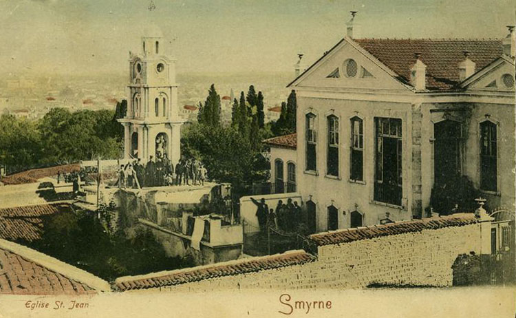
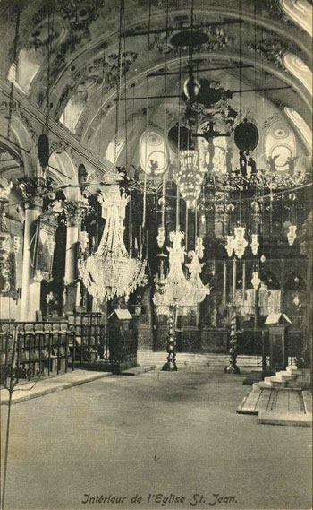
St. John’s Cathedral |
old hospitals street now Vasıf Çınar Bulvarı, Alsancak |
1874 |
Functioning |
St. Maria |
Pasaport, old Maltezika |
1899 |
Functioning |
Holy Rosary (previously St. Peter and Paul) |
Alsancak, old Punta |
1904 |
Functioning |
Ivrea Sisters |
Alsancak, old Punta |
? |
Functioning - gallery |
St. John the Baptist |
Alsancak |
? |
Standing |
St. Joseph chapel |
St. Joseph School, Alsancak, old Punta |
? |
Standing |
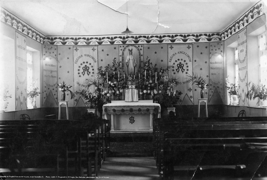
Chapel of the French Hospital |
Alsancak |
? |
Standing |
the Chapel of the College Sacre Coeur of the Lazaristes |
Alsancak Ticaret Lisesi, Pasaport |
? |
Lost |
St. Antoine |
Bayraklı |
1922 |
Functioning |
St. Helen |
Karşıyaka |
1906 |
Functioning |
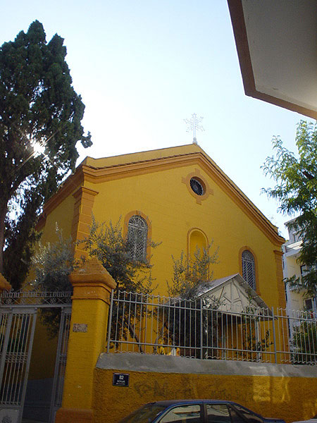
Notre Dame de Lourdes |
Göztepe |
1902 |
Functioning |
St. John the Baptist |
Boudja |
1840 |
Functioning |
St. Maria |
Bournabat |
? |
Functioning |
St. Ludovico Gonzaga |
? |
? |
? |
Armenian Catholic |
|||
St. John the Theologian |
Punta? |
? |
Lost |
Greek Orthodox |
|||
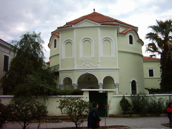
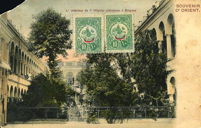
Agios Charalambos (chapel of the Greek hospital) |
Hospital quarter (Spitalia), east of New Quarter |
1833 |
|
Agios Ioannis Prodromos (Kerasochoras) |
Schoinadika, south of Punta |
built before 1818, rebuilt 1856-57 |
|
Agios Georgios |
Agios Georgios quarter, centre |
1623 |
Lost |
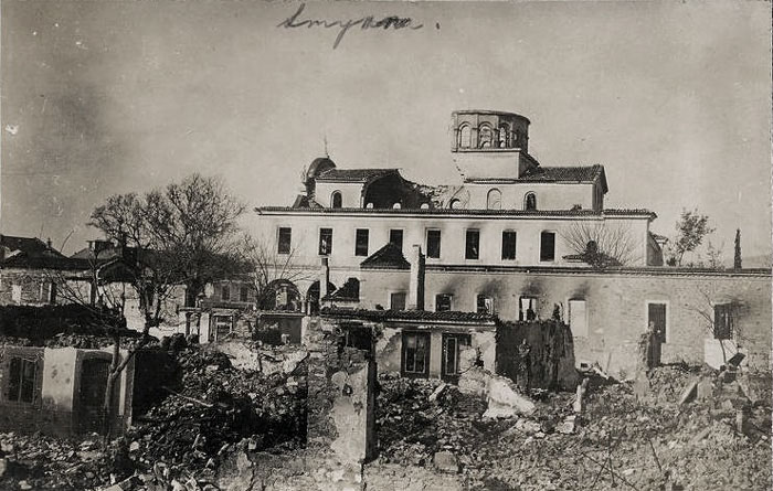
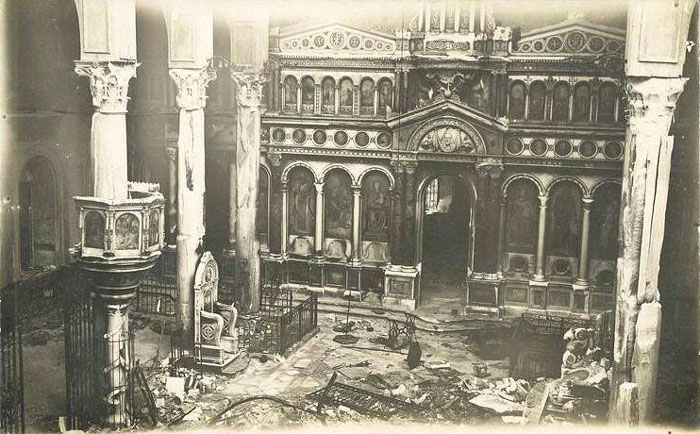
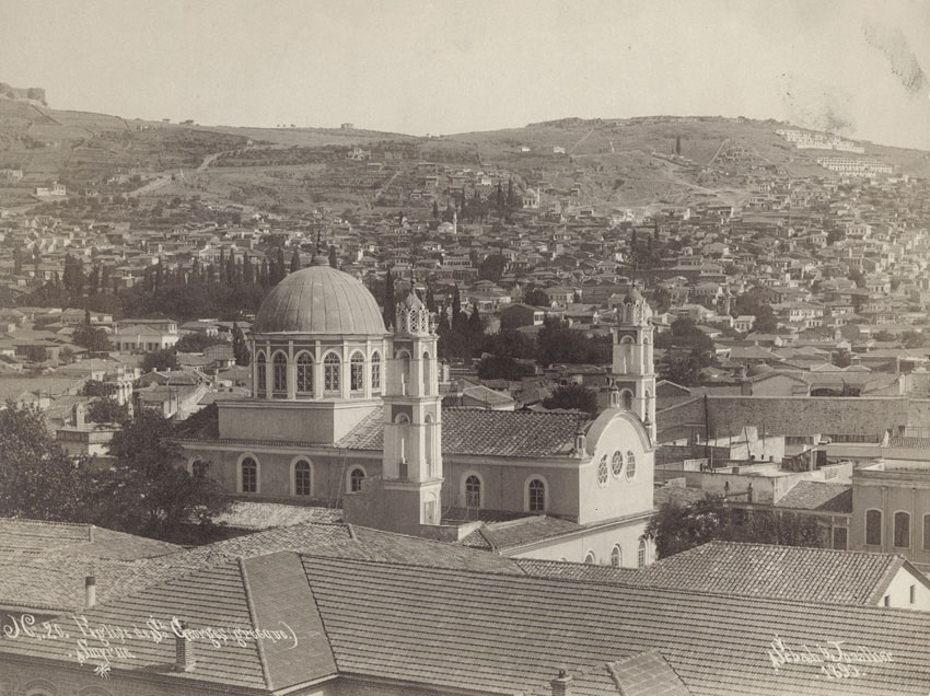
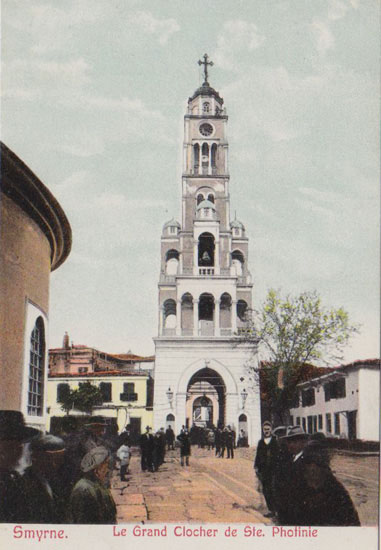
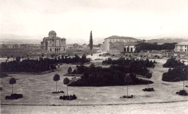
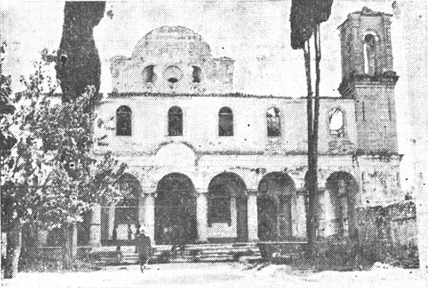
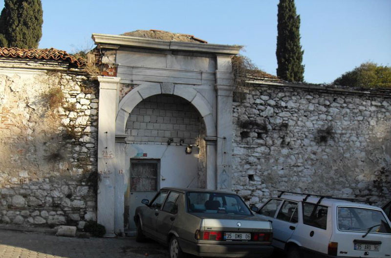
Agia Photini (cathedral) - gallery |
Agia Photini quarter, centre |
built 17th century, belfry built 1856 |
Lost |
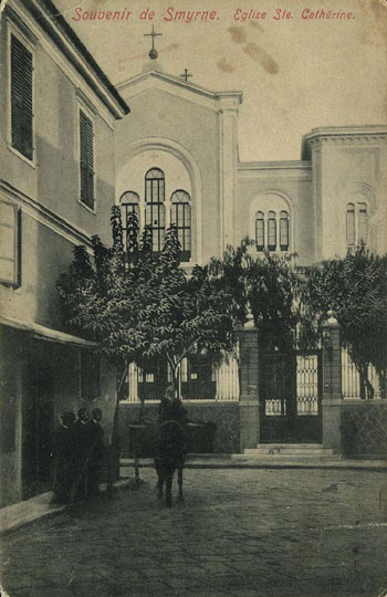
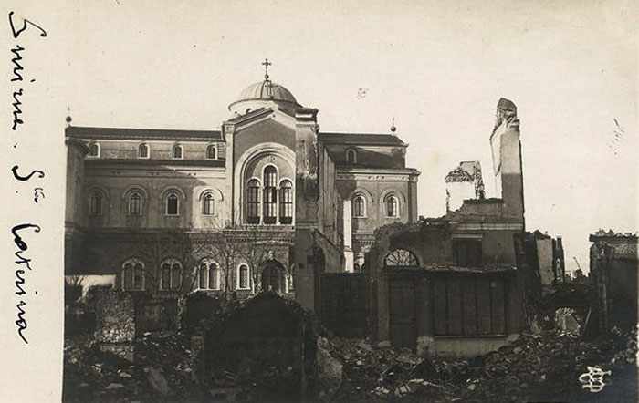
Agia Ekaterini - gallery |
Agia Ekaterini quarter, south of Schoinadika |
built wooden 1857, rebuilt 1898 (largest church in Smyrna) |
|
Agios Dimitrios |
Agios Dimitrios quarter, east of Hospital quarter |
built 1830 |
Lost |
Evangelismos Theotokou (Annunciation of Virgin Mary) |
Tabahana, north of Basmahane and south of Agios Dimitrios quarter |
built 1867, rebuilt 1908 |
Lost |
Agios Nikolaos |
Agios Nikolaos quarter, east of Tabahana quarter |
1884 |
Lost |
Koimisis Theotokou (Assumption) |
Parelleli (İkinci Kordon), centre |
1871 |
Lost |
Genethlia Theotokou (Birth of Virgin Mary) |
Fassoula, west of Agia Ekaterini quarter |
elevated to parish church 1885 |
|
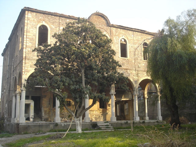
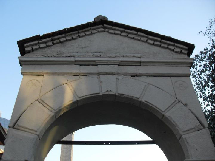
Agios Voukolos & Polykarpos |
Agios Vouklas, south of Basmahane |
built 1866 on site of ancient church |
Standing and restored 2010 to serve as a cultural centre |
Agios Konstantinos & Eleni - location maps |
Chiotika (Tepecik), east of Meles river |
1862 |
Lost, demolished c. 19614 |
Agios Tryfon |
Agios Tryfon (Tsikoudia) quarter, west of Mortakia |
built 1887-94 |
Lost |
Metamorfosis Sotiros (Transfiguration of Christ) |
Mortakia |
built 1860, enlarged 1878 |
Lost |
Metohion Panagia Kykkou |
Juderia |
? |
standing - postulated position |
Agios Ioannis Theologos |
Upper Town (Pano Machalas), south of Juderia |
built ~1700, burned 1773, rebuilt after that, rebuilt larger 1804 |
Ruins of local Greek school and teacher’s residence |
Agios Ioannis Prodromos |
Boudja, upper town |
built 1796, rebuilt 1854 |
|
Evangelismos Theotokou (Annunciation of Virgin Mary) |
Boudja, lower town |
built 1903 |
|
Agios Ioannis Apokefalistheis (Beheaded) |
Boudja, Tria Pigadia (Üçkuyular) |
built 1865 |
? |
Agia Anna Kourelou |
East of Pagos hill, further on the road to Boudja |
? |
? |
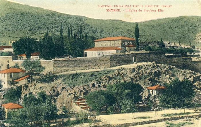
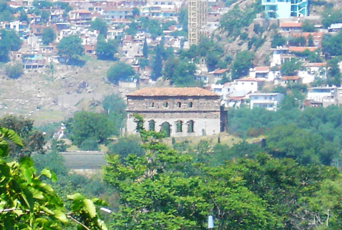
Profiti Elia Monastery |
Kamares (Arches, aquaeducts), on the road to Boudja - St. Anne’s Valley |
built 1844-46 |
|
Agia Paraskevi |
Karatasi (Melantia) |
? |
Lost - possibe remains gallery |
Agia Marina |
Kokaryalı (Myracti) |
? |
? |
Metamorfosis Sotiros (Transfiguration of Christ) |
Karantina |
? |
converted - gallery |
Michael Archon (Archangel) (chapel of Greek cemetery)3 |
Daragatsi (Darağaç), east of Punta |
built 1878 |
Lostgallery of possible remains of cemetery |
Agios Ioannis Prodromos |
Cordelio |
1818 |
Lost |
Metamorfosis Sotiros (Transfiguration of Christ) |
Papa Skala (Bostanlı), Cordelio |
? |
Lost |
Agia Anna (cathedral) |
Cordelio |
rebuilt 1898 |
? |
Agia Marina |
Alaybey, Cordelio |
? |
? |
Agios Dimitrios |
Tomazo, Cordelio |
? |
? |
Agios Ioannis Theologos (or Prodromos?) (chapel of Greek cemetery) |
Cordelio |
? |
? |
Agios Ioannis sten Alygaria Paraxysmou (Malaria-healer) |
Alygaria (south of Darağaç), Tenekeciler quarter, near Mortakia |
1910 |
Standing - gallery |
Agia Markella |
Daragatsi (Darağaç), between Punta and Halkapınar |
? |
Lost - sketch |
Panagia Myrtidiotissa |
Mersinada (Mersinli), east of Halkapınar |
built wooden 1891, rebuilt 1903 |
Lost |
Agia Kyriaki |
Near Agia Markella (maybe Halkapınar?) |
? |
Lost |
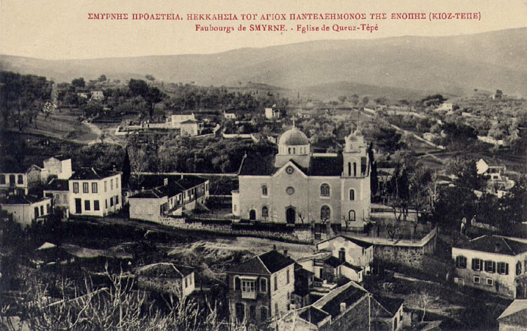
Agios Panteleimon |
Göztepe |
? |
Lost? |
Timios Stavros |
Narlıköy (now Doğanlar), near Bornova |
? |
Standing |
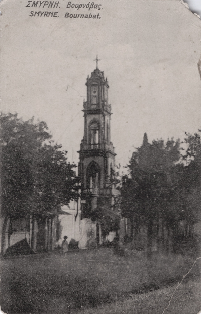
Koimisis Theotokou (Assumption) |
Bournabat |
built ca. 1772, rebuilt 1839-1840 |
Lost? |
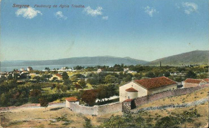
Agia Triada (Holy Trinity) (chapel of Greek cemetery) |
Bournabat |
built 1864 |
? - sketch |
Analipsis Sotiros (Ascension of Christ) |
Bayraklı |
1845 |
Converted (Merkez Camii) |
Agia Triada (Holy Trinity) (small Byzantine church) |
Agia Triada (Turan) |
? |
Lost? |
Agios Ioannis Theologos |
Seydiköy (Gaziemir) |
built ca. 1796 |
? |
Agios Ioannis Prodromos |
Seydiköy (Gaziemir) |
? |
? |
Agia Irini |
Tzimovasi (Cumaovası) |
? |
? |
Agios Trifonas |
Pınarbaşı |
? |
? - sketch |
Timios Stavros |
Doğanlar (Narlıköy) |
? |
standing, restored 2014 - gallery |
Armenian Orthodox (Gregorian) |
|||
St. Gregory the Dialogist (Surp Krikor) within its hospital |
Basmane / Haynot |
? |
Lost |
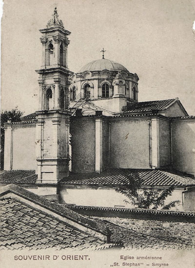
St. Stepanos (St. Etienne) Cathedral - gallery |
Rue Rechidie, Haynot (Armenian quarter) |
? |
Lost |
Surp Harutyun1 |
? |
? |
Lost |
Holy Cross2 |
Bornova |
? |
Lost |
Surp Garabet2 |
Karataş |
? |
Lost |
Surp Asdvadzadzin2 |
Cordelio (Karşıyaka) |
? |
Lost |
Surp Hokekalust or Surp Yerrortutyun2 |
Göztepe |
? |
Lost |
Surp Takavor2 |
Bayraklı |
? |
Lost |
Anglican |
|||
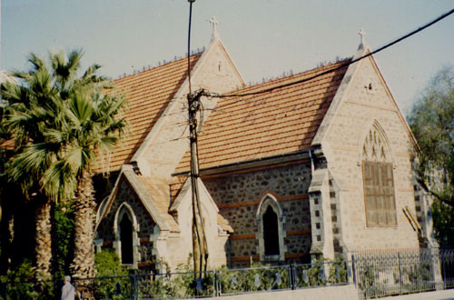
St. John the Evangelist |
Alsancak |
1899 |
Functioning |
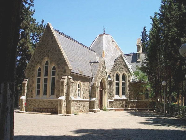
St. Mary Magdelene |
Bournabat |
1857 |
Functioning |
All Saints |
Boudja |
1865 |
Functioning |
Protestant |
|||
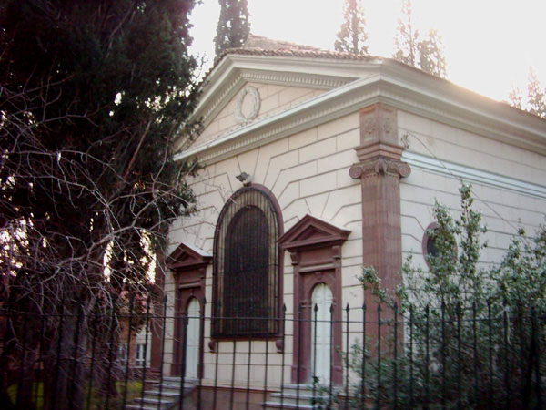
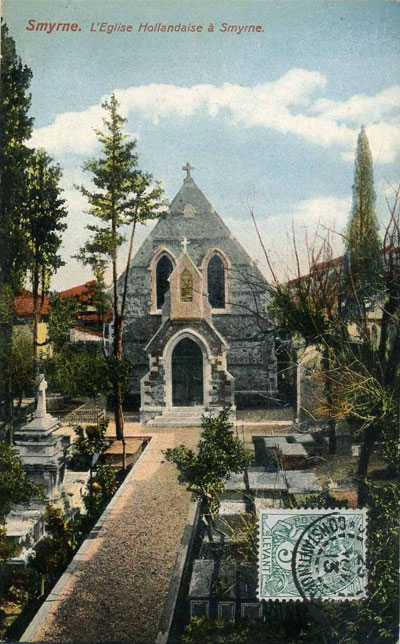
Dutch (now Agia Photini) |
Alsancak |
? |
Standing |
German Protestant Deaconnesses Mission |
Opposite the Roman Catholic Cathedral |
? |
|
Presbyterian (Scotch Mission) |
Rue de Meles, Armenian Quarter |
? |
? |
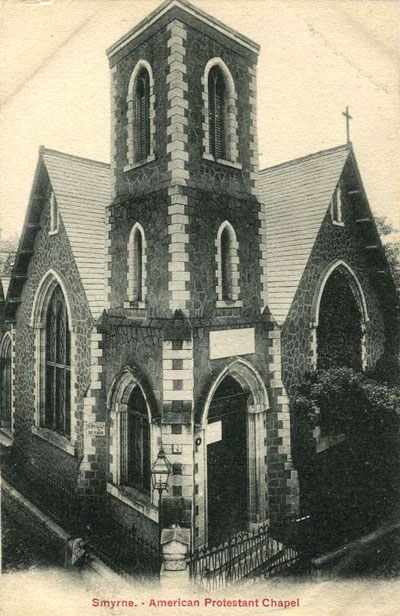
American (Armenian) Protestant (later transferred to the Scotch Mission) |
Armenian Quarter |
? |
lost |

Translation from Greek courtesy of George Poulimenos of papers by Aleka Karadimou-Gerolymbou:
“In general, of the 21 churches functioning in 1922, 16 were built in the 19th century, humble at first and often richer afterwards, while 5 date from older times (amid them was St. Paraskevi, which was destroyed during the Greek Revolution). Older than the 19th century is considerede the “ancient” St. John the Theologian in the Smyrna Upper Town, which was last reconstructed in 1804. The other church of the Upper Town, St. Voukolos, was founded in 1866 on the site of an ancient Christian church. Both were located in the older Greek quarters, and they were spared the fire of 1922.
In the older churches are included: St. Photini, the best known church of Smyrna (cathedral since the 17th century, when it replaced St. Paraskevi), whose very impressive belfry was built in 1856 by the architect Xenophon Latris, and St. George, probably on the site of St. George Out of the Castle, a dependency of the Lemvon Monastery. It was built in 1623 and repaired many times (1772, 1792, 1856 etc.)
The remainder of the churches mark the construction of the newer city quarters.
St. John Prodromos is mentioned since 1818 in the quarter Schoinadika (Rope makers), just before Punta. It was rebuilt in 1856-57 by 300 poor workers who lived in the quarter.
The construction of St. Demetrius started in 1833, in the vicinity of the Greek Hospital, and in same year St. Charalambos was built within the precinct of the same hospital.
The church of Prophet Elias was built between 1844 and 1846 near the old aqueduct (Kamares, Arches).
In 1857 St. Ekaterini was erected of wood, and was rebuilt in 1898 on plans of the architect X. Latris. It became the biggest church in Smyrna.
In the quarter Mortakia a church was built in 1860, extended in 1878. It was dedicated to the Transfiguration of Christ and in 1908 it became the parish church.
In 1861 St. Constantine was built in the quarter Chiotika (Tepecik), by Chians who escaped to Smyrna after the massacre of 1822. This church is the third which did not suffer from the fire of 1922.
In 1867 the church of Evangelistria is built in the Cay quarter, at first as a small wooden church and later rebuilt on plans of architect Vasilios Lyttis. It was located between the St. Demetrius and St. Nicolas quarters.
In 1871 the church of the Assumption was built on the first parellel road to the quais.
In the Greek Orthodox cemetery (just east of the Aydın railway station), bulit in 1865, the church of Michael Archon was erected in 1878 on plans of the architect X. Latris.
In 1884 St. Nicolas was erected in the Cay quarter, on plans of architect I. Christodoulou.
In 1885 the dependency of the Birthday of Mary was converted to parish church of the Fassoula quarter.
In 1887 the construction of St. Tryphon began in the quarter which beared its name. The church was ready in 1894.
The Myrtidiotissa church was built wooden in the Mersinli quarter in 1891 and rebuilt in 1903 on plans of the architect Constantinidis, supervised by architect G. Petrokokkinos.
In 1908 the St. Markella church was erected by Chians in the parish Daragach, which begun after Punta and ended at Halka Pinar. In the vicinity there was also the church of St. Kyriaki. Lastly, in 1910 St. John of Alygaria was built in the quarter of the same name, just beside the Smyrna-Aydin railway line.”
2 Source: 100 yıl önce Turkiyede Ermeniler [The Armenians of Turkey 100 years ago] - Editor Osman Köker -Bir zamanlar yayıncılık - Surp Asdvadzadzin equates to Theotokos or Mother of God.
3 Also known as the church of the Taxiarchon.
4 According to the book ‘Küllerden doğan sehir, Izmir 1922 - Murat Köylü, 2010’ [City born out of ashes, Izmir 1922].
The Latin Churches and Chapels of Smyrna in 1876, according to the Greek guide:
“Imerologion ke Odigos Smirnis tu Visektu Etous 1876”, by Th. K. and S. K.
1) St. Maria (Cathedral)
2) St. Polycarpe, Capuchins
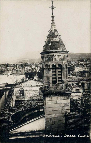
3) Sacred Heart, Lazarites
4) St. Peter & Paul, Dominicans
5) St. Ludovico Gonzaga, chapel of the Propagande School, Jesuits
6) Birth of Virgin Mary [Yenniseos tu Theotoku], chapel in the School of the Mechitarists
7) St. John the Baptist, chapel of the French Hospital
8) St. Antoine, chapel of the Austrian Hospital
9) St. Joseph, chapel of the Freres’ School
10) [Sillipseos], private chapel belonging to the Eleus Brothers
11) [Kimiseos] (Assumption ?), private chapel belonging to the Braggiotti Family, Kapellas Sokak, Panteloglu Yolu, open to the public.
In the “Annuaire des Commerçants” of 1893, are mentioned also (as “culte catholique”);
12) Chapel of the St. Roch Hospital
13) St. Anne Chapel in the St. Anne Valley (Catholic Cemetery)
14) St. Roch Chapel, Mortakia
15) Private Chapel of the Archbishop
16) Private Chapel of the Charity Sisters (Providence)
17) Private Chapel of the Sion Sisters
18) Private Chapel of the Ivrea Sisters
(The actual Chapel of the Ivrea Sisters was built in 1958,).
From the “Indicateur des professions commerciales et industrielles de Smyrne” of 1895:
In Göztepe there is a private (Catholic) chapel belonging to the Braggiotti Family, the Orthodox St. Pantaleon Church, built 2 years ago (1893) and an Armenian Church.
In Cordelio, there are 2 Orthodox, 1 Armenian Church, and a Catholic church dedicated to St. Helen and built by the De Cramer family.
In Narliköy, a church dedicated to the St. Trinity and a Greek church.
In Karataş, 1 Greek and 1 Armenian Church.
In Bornova, 1 Protestant church (property of Mr. Whittall), 1 Armenian church, 1 Greek Church, and 2 Catholic churches: Nativity of the Holy Virgin and St. Michael.
In Buca, 1 Catholic church: St. John the Evangelist, and 1 Greek Church.
The old names of the quarters were used as the documents pertaining to these records are mostly from archives written in Greek - below their correspondence to modern names:
Ayrancilar: Trianda
Basmane: Agias Vuklas
Bornova: Bournabat, Akropedon, Pirino Barys
Bostanlı: Papa Skala, Papaz Iskelesi
Bulgurca: Malcajik
Buca: Kohl, Boudja
Çiğli: Silleon
Cumaovası: Tsimovasi
Darağaç: Cerenage / Daragatsi
Fuar: Fasoula, Agias Photini
Gaziemir: Imerion / Kazaemir
Gökkaya: Melanpagos
Göztepe: Enopi
Güzelyalı, Kokaryalı, Üçkuyular: Myracti, Mirakti
Harmandalı: Armanda
Havra Sokağı, Keçeçiler, İkiçeşmelik: Juderia
Hilal: Stavros
İkinci Kordonboyu: Paralelli
İnciraltı: Nea Kastro / Sikies
Kadifekale: Pagos
Kahramanlar: Mortakya
Karantina: Kallithea
Karataş, Mithatpasa: Melantia / Karatasi
Karşıyaka: Cordelio
Kızılçullu, Şirinyer: Paradeiso
Naldöken: Petrota
Namazgah: Agora
Narlıdere: Akhilleion
Pınarbaşı: Periklistra
Sancaklı: Mormonda
Salhane: Sfaktiria
Susuz Dede: Ayos Agopi
Semikler, Kara Bostanlısı: Tomaza
Tepecik: Kintus, Qintus
Turan: Agia Triada, Teganion
Yamanlar: Sipvlos, Amanara
Yazıbaşı Köyü: Fortuna
 |
 |
 |
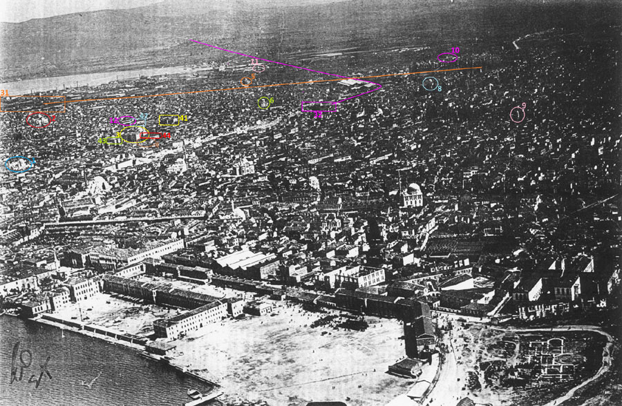 |
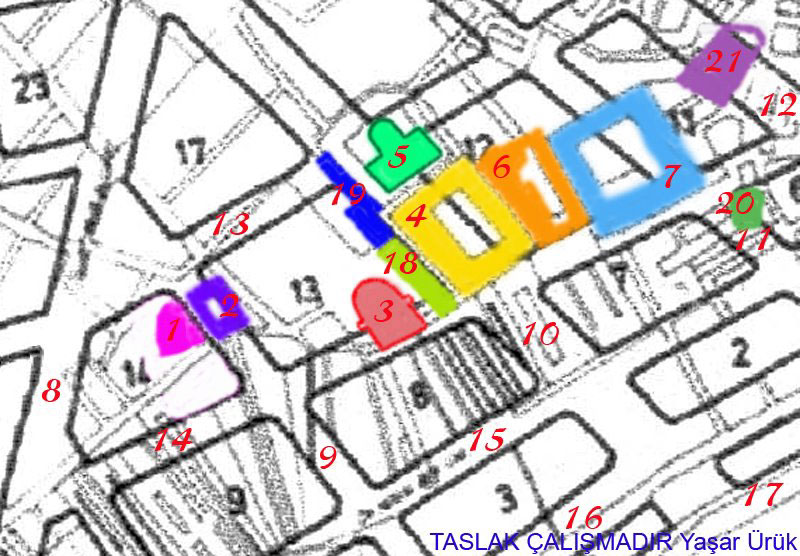
1. St. George church (certain)
2. St. Catherine church (certain)
3. St. Stephen Armenian church (certain)
4. St. Paraskevi dependency (almost certain, see Bon map)
5. St. John Prodoromos in Alygaria (certain, because of its location in relation to the railway lines)
6. Evangelistria church (certain, as it is in the correct location and has the correct shape. The axis of the Evangelistria church, as seen in all photos, was not east-west but, probably because of the plot shape, southeast-northwest, while the sanctuary diverged to the north and the main entrance was to the south)
8. St. Voukolos church (almost certain, shape and location fits)
9. Bell Tower of the church of St. John the Theologian in Apano Mahala (certain, shape, location and proportions of bell tower fit)
10. St. Constantine church (almost certain, its location resulted from calculations. The church must be the left building inside the cirle)
11. St. Markella in Daragatch (almost certain)
12. St. Demetrius church (almost certain, location, size, orientation and style fit. In a book by Kartsonakis the church is described as not having a dome or bell tower)
Other Buildings
31. Punta railway station and the railway line to Aydin (orange, certain)
32. Basmahane railway station and the railway line to Kasaba (violet, certain. The location of the station building was confirmed by calculation)
41. Armenian Hospital (almost certain. Location and size of the building fit)
42. Hadji-Antonios School, Greek (almost certain. It is described as a large building bordering the south side of the St. Demetrius yard)
43. Armenian Archdiocese (almost certain, this is the location indicated in the Armenian Quarter map)
44. St. Mesrop Boys School, Armenian (almost certain, location taken from the same Armenian Quarter map)
Note:
The identification process continues and some things may change if new data arise or new suggestions (always welcome) are made - some post-1922 aerial photos of the fire zone.
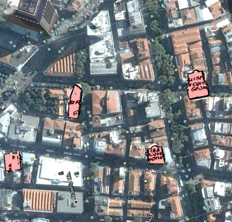
Gümrük Area of Alsancak
 |
 |
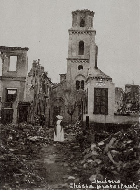
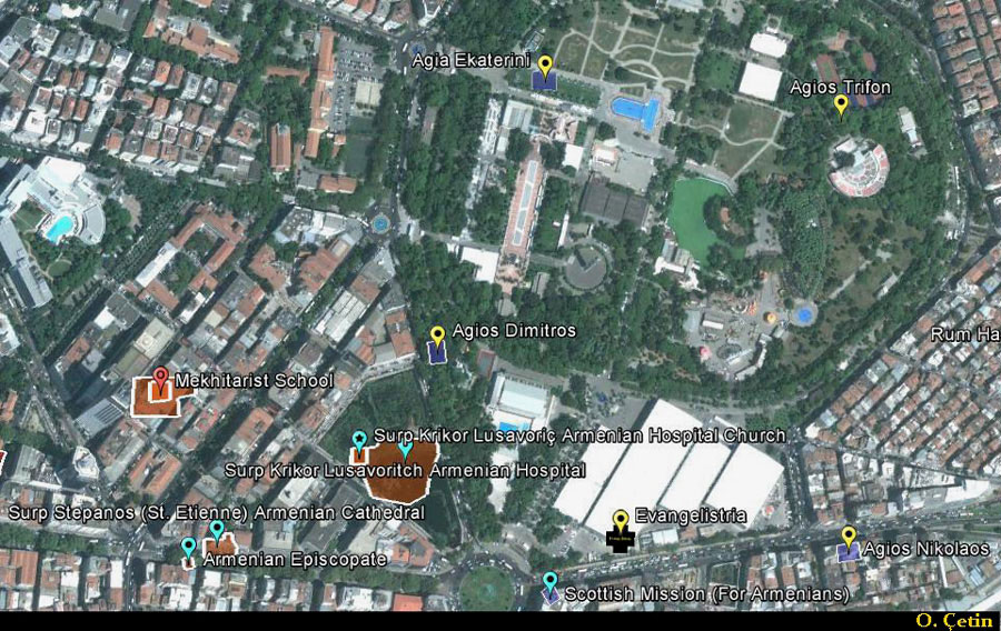
Note: Click here to view contents of a British Consular report of 1903 detailing that nation’s own possessions in the city.
Fair Area of Alsancak
 |
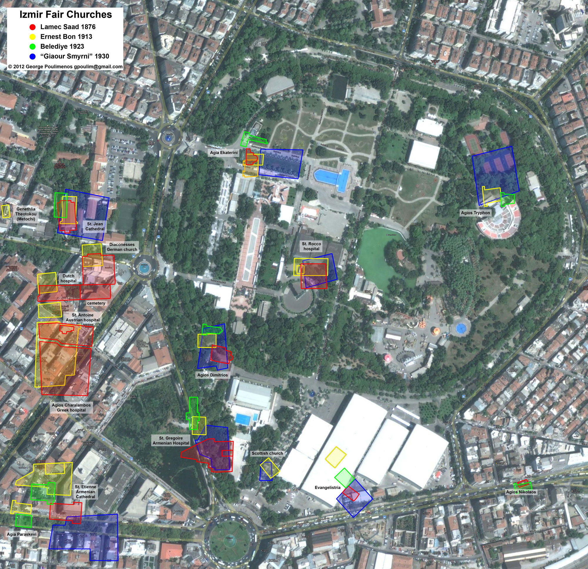 |
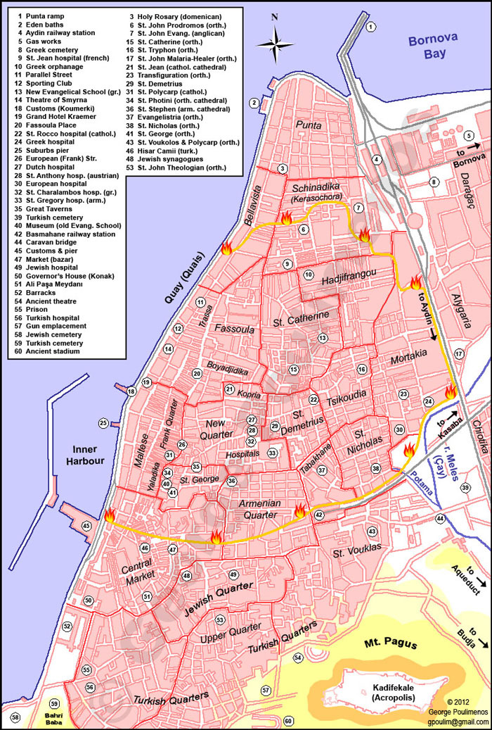
A composite based on multiple archive maps for the location of former churches in and around the Izmir fair site. Five old maps were used: the Lamec Saad map of 1876, two versions of the Ernest Bon map of 1913, the Belediye [Municipality] map of 1923 and a map published ca. 1930 in a Greek newspaper, the “Giaour Smyrni” map, which is based on the Bon map. All maps were scaled and overlayed on a modern Izmir Google map, using as reference points the Punta tip, the old harbour breakwater and the railway lines crossing. The maps were shifted about 30 meters to the northeast, to let the St. Jean Cathedral of the maps coincide with the same building shown on the Google map. Then the outlines of the churches and some other buildings from the old maps were drawn on the modern map. Buildings from the Lamec Saad are drawn in red, from the Bon in yellow and orange, from the Belediye in green, and blocks (not buildings) from the Greek map in blue. On the resulting map, buildings from the old maps fall not too far one from the other, except the Evangelistria church, whose location on the Bon map doesn’t coincide with the other maps. One interesting result is the location of current Agia Photini, the old Dutch chapel, which is inside the rectangle marked “cemetery”, at the left side. This cemetery is on the Lamec Saad map adjacent to the Dutch hospital, just to its east. The chapel itself is not depicted on any map, but its current location indicates (proves?) that it actually belonged to the Dutch hospital complex - image and analysis courtesy of George Poulimenos, 2012 - click image for larger view.